
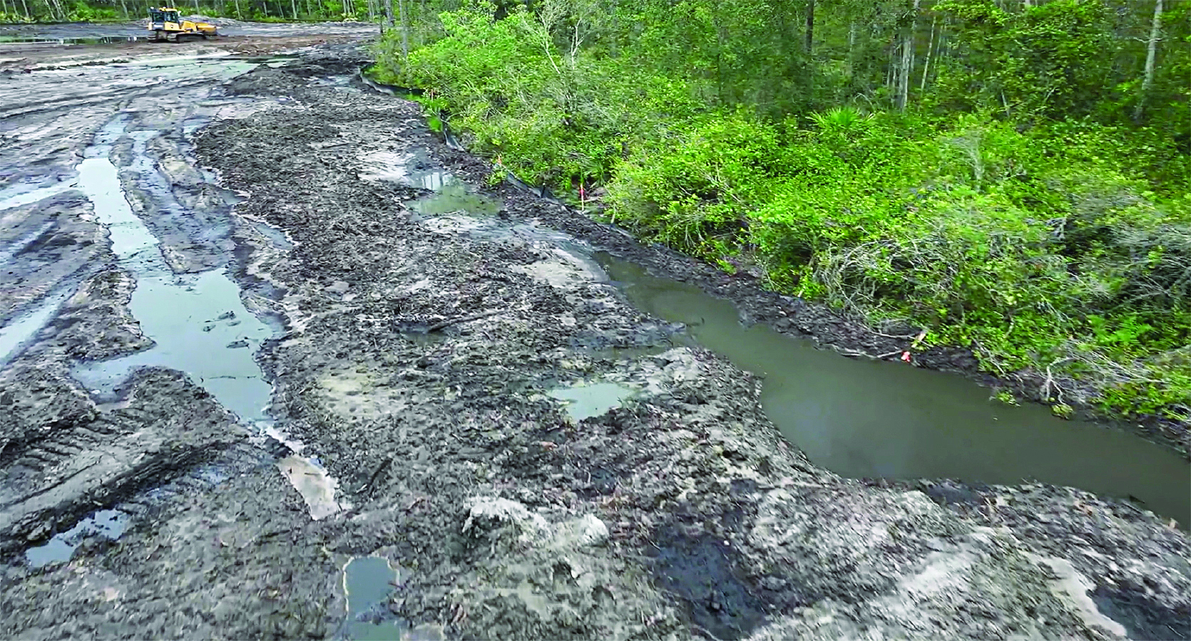
Drones help integrate monitoring, data capture, and analysis while increasing site accessibility
By Matt Harvey and Mitchell Baldwin
In today’s land development landscape, environmental compliance is no longer a reactive process; it is a continuous, data-driven responsibility. With increasing regulatory pressure, tighter margins, and growing environmental awareness, engineers, developers, and contractors must adopt smarter, faster, and more reliable ways to monitor and manage their sites.
Drone technology has emerged as a powerful tool in this evolution, but its true value lies not just in aerial imagery—it lies in how and what data is captured, analyzed, and applied. Environmental management must integrate accessibility, accountability, artificial intelligence, and remote automation into a single, scalable solution.
Accessibility: Turning Sites Into Data Sources
Construction and development sites are dynamic and often difficult to navigate for inspectors. From steep slopes, stream crossings, and sediment basins to wetlands and active earthwork zones, traditional inspection methods can be time-consuming, labor-intensive, and—in some cases—unsafe. Drone-based data collection can fundamentally change this equation.
By deploying high-resolution aerial mapping and photogrammetry, stakeholders can capture comprehensive site data without having to physically traverse hazardous terrain. What once required hours of manual inspection can now be completed in minutes with significantly greater coverage and precision.
More importantly, increased accessibility allows for more frequent monitoring. Instead of relying on periodic site walks, project teams can adopt a continuous oversight model—capturing weekly or even post-event datasets that provide a clearer picture of how conditions evolve over time. The result is safer inspections and smarter decision-making driven by consistent, reliable data.
Accountability: Creating a Single Source of Truth
Environmental compliance is built on documentation and trust. Whether it’s verifying the installation of BMPs, responding to a regulatory inquiry, or defending against a claim, accurate records are essential. Traditional documentation methods that combine ground-level photos, handwritten reports, and fragmented communication may not always convey a comprehensive range of facts.
Drones can address this challenge by creating a centralized, visual record of site conditions. Every flight produces time-stamped, georeferenced data that can be revisited at any time. This creates a clear timeline of progress, compliance, and corrective actions. This level of transparency benefits all stakeholders:
- Developers gain confidence that their projects are meeting regulatory requirements.
- Contractors have clear visual guidance on expectations and performance.
- Inspectors and consultants can validate conditions without ambiguity.
In an industry where disputes can be costly and time-consuming, having a single source of truth is invaluable.
AI-Driven BMP Detection: From Observation to Prediction
While capturing data is critical, the next step—interpreting that data—is where innovation is accelerating most rapidly. Artificial intelligence can help monitoring move beyond simple observation and toward proactive compliance management.
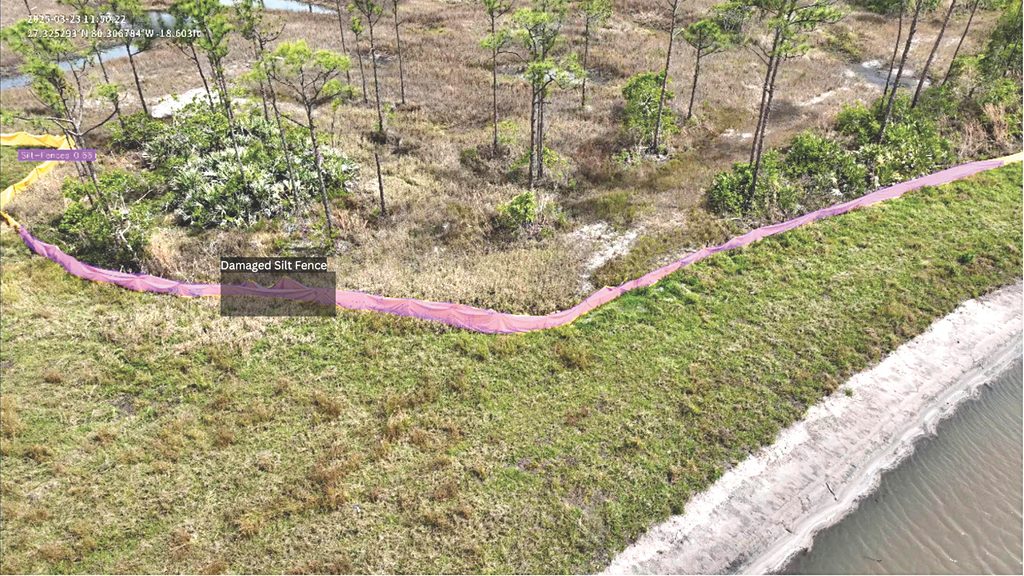
AI-powered image analysis allows users to automatically identify common erosion and sediment control measures such as silt fences, inlet protections, and check dams and assess their condition. This allows project teams to quickly pinpoint missing or improperly installed BMPs, damaged or compromised BMPs, and areas at high risk of noncompliance. This takes inspections from a manual, reactive process to an automated, predictive system.
Instead of waiting for an inspector to flag an issue, teams can address potential problems before they escalate into violations, fines, or environmental damage. As these systems evolve, AI will not only detect issues but also identify patterns, helping teams anticipate where failures are most likely to occur.
Remote Drone Operations: Redefining Speed and Scalability
One of the most significant advancements in drone technology is the emergence of drone-in-a-box systems, enabling fully remote operations. Drones can be stationed on-site and operated remotely, eliminating many of the logistical constraints associated with traditional drone deployments. The impact is substantial, enabling:
- Rapid response after storm events, when inspections are most critical;
- Reduced operational costs, with no need for on-site pilots; and
- Scalable monitoring across multiple projects and regions.
Such consistency and responsiveness was previously unattainable, especially for large developers managing dozens of active sites. Imagine a future in which every site is monitored automatically after rainfall, with data processed and flagged for issues within hours. That future is no longer theoretical; it is actively being implemented.
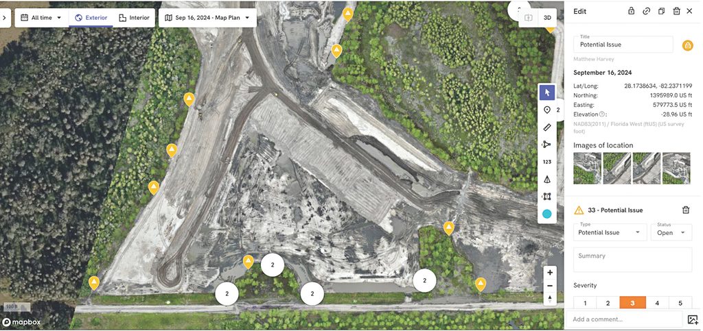
Maximizing Every Flight
For land developers, the value of drone technology extends far beyond environmental compliance. While erosion control and stormwater inspections are critical, they represent just one piece of a much larger operational picture.
Every flight should be designed to deliver multidimensional value, allowing developers to extract multiple datasets from a single deployment. This means that the same mission used to verify compliance can also generate actionable insights for construction progress, earthwork tracking, and site optimization.
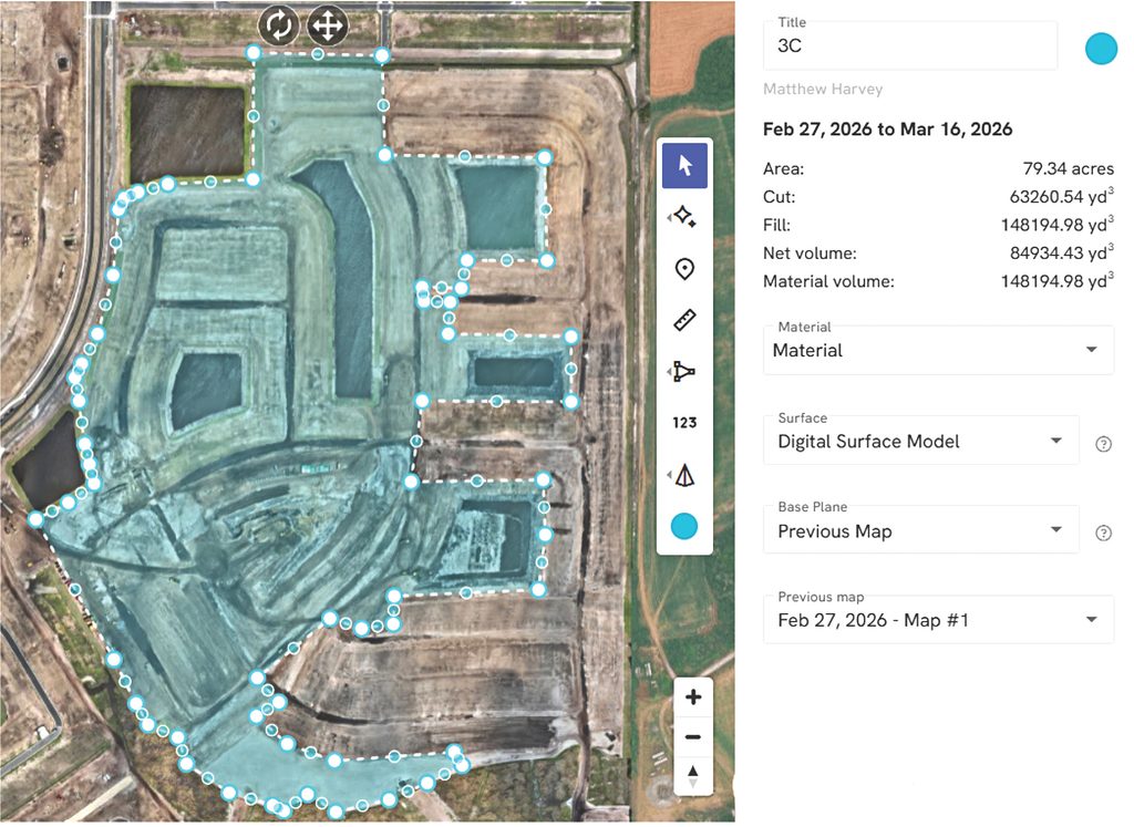
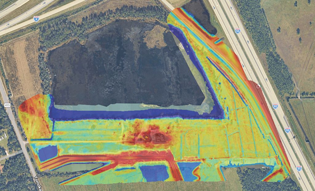
One of the most impactful applications is dirt tracking and volumetric analysis. By leveraging high-accuracy mapping and repeatable flight paths, developers can monitor cut-and-fill activity in near-real time. This provides visibility into how much material has been moved, how site grading is progressing, and whether earthwork operations are aligning with project plans. Instead of relying solely on periodic survey updates, teams gain a consistent, visual, and measurable understanding of site movement throughout the life cycle of the project.
In parallel, drone flights produce up-to-date topographic information that can be useful to multiple stakeholders. Engineers, project managers, and contractors can work from the same current datasets, reducing miscommunications and ensuring that decisions are based on the latest site conditions. This is especially valuable on fast-moving developments where outdated information can quickly lead to costly mistakes or rework.
Progress tracking is another key advantage. High-resolution orthomosaics and 3D models create a clear, chronological record of site development from initial clearing to final lot delivery. Developers can easily monitor buildout status; track infrastructure installation; and communicate progress to internal teams, investors, or partners. Visual documentation not only improves transparency but also strengthens reporting and project oversight.
What makes new drone technologies powerful is that all of these insights can be captured simultaneously. There’s no need to schedule separate flights for compliance, surveying, and progress monitoring. Environmental inspections, including BMP verification and erosion control assessments, are seamlessly integrated into the same dataset used for operational analysis.
The result is a more efficient, cost-effective workflow—and that means fewer site visits and reduced operational overhead; consistent, reliable data across all project functions; and faster decision-making with real-time visibility. For developers managing multiple projects, the unified approach transforms drone data from a niche tool into a core operational asset.
Aligning environmental compliance with construction intelligence helps land developers not only stay compliant, but build smarter, faster, and with greater confidence.
From Compliance to Optimization
While the immediate value of drone technology lies in improving compliance, its long-term potential is far greater. As datasets grow and technologies mature, developers will be able to leverage aerial data not just for monitoring, but for optimizations such as:
- Identifying inefficiencies in site grading and drainage;
- Improving stormwater management design based on real-world performance;
- Reducing rework and material waste; and
- Enhancing overall project timelines and cost controls.
Environmental management will no longer be viewed as a regulatory burden, but as an integrated component of smarter, more efficient development.
The construction industry is at a turning point. Increasing complexity demands better tools, and better tools demand a shift in how ESC professionals think about data, accountability, and innovation. Drone-powered monitoring can help developers move toward proactive, data-driven environmental management. In combining accessibility, accountability, AI-powered insights, and remote automation, we are not just improving site monitoring; we are redefining what’s possible. n
About the Expert
Matt Harvey is the owner and CEO of Edge Drone Services, a nationwide provider of aerial data and scalable drone solutions for construction, development, environmental, and media projects based in Tampa, Florida.
Mitch Baldwin is business development manager for Edge Drone Services. With a background in aviation, he is a certified Part 107 and Florida Stormwater, Erosion, and Sedimentation Control Inspector.