Home Blog Page 2

Unlocking Land Value in FEMA Floodplains

Fig. 1: FEMA Zone A Stream

WITH DEVELOPABLE LAND IN short supply, more developers and engineers are eyeing parcels on the edge of mapped floodplains. These sites often look promising—they are close to infrastructure, near growth corridors, and seemingly outside the most restrictive floodway zones.

However, such parcels carry some of the highest entitlement and construction risks, especially when FEMA floodplain reclamation is part of the equation. After two decades collaborating with real estate developers, civil engineers, contractors, and floodplain administrators, one lesson stands out: Success hinges not on complex modeling, but on early, informed decisions and a respect for how water moves through a site.

Say you’ve found a parcel with FEMA floodplain designation and are considering reclaiming some of it for development or resale, or perhaps you’re representing a client with similar ambitions. The first question is always, “How much can I reclaim?” The answer: It depends. Here are eight things you need to consider before moving forward.

1. Flood Risk Is More Than a Map

A mapped floodplain signals real flood risk. Just because a site hasn’t flooded recently—or ever—doesn’t mean it won’t. The “1% annual chance floodplain” (often called the 100-year floodplain) means there’s a 1% chance a flood will reach that level each year. It could happen multiple times a year, or not at all for decades. For design professionals, this designation provides a minimum baseline for setting habitable structure elevations and ensuring safety.

2. Decoding FEMA Zone Designations

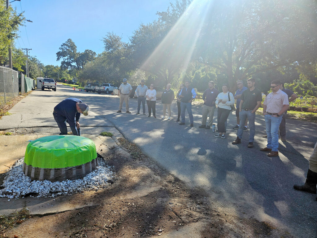
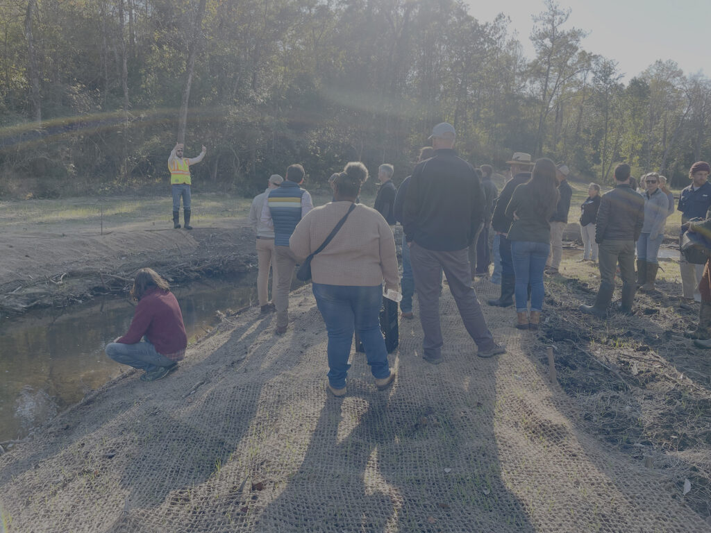
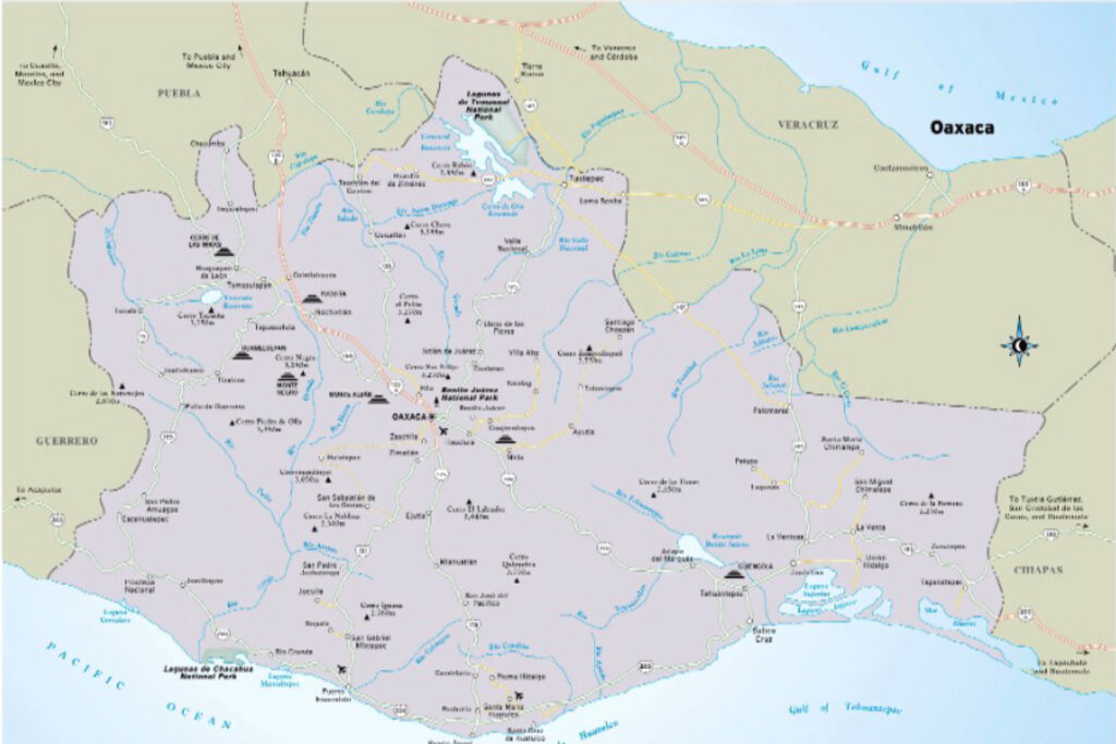
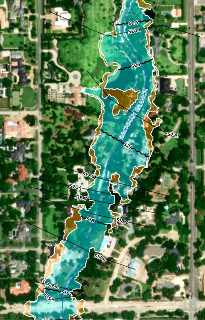
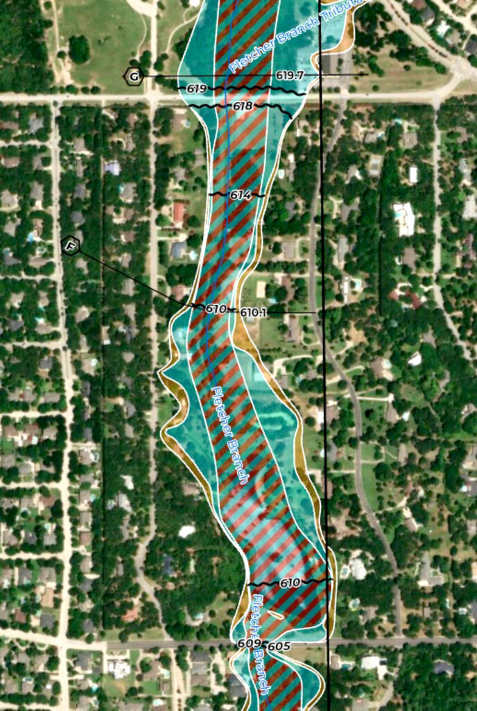
FEMA’s alphabet soup of zones—A, AE, A1-30, AH, AO, A99, V, VE, V1-30—can be confusing. On most projects, you’ll see Zones A and AE (Figs. 1–3). Zone A is often mapped with limited data and may lack defined flood elevations, making it unreliable for precise design. By contrast, Zone AE streams are studied in detail, with hydrology and hydraulic (H&H) models supporting the mapped risk, base flood elevations, and sometimes a defined floodway. Knowing your site’s designation is essential for responsible planning.

You should also know what level of development the site had when the study was done. Some municipalities require even detailed studies to be redone assuming full development based on zoning or planning, which can increase final water surface elevation significantly.

Fig. 4: FEMA Zone AE and CLOMR requirements flow chart

3. Local Standards Set the Bar High

FEMA requires mitigation for any adverse impact to water surface elevations, but many localities go beyond these mandates. You may need to evaluate channel velocities, stream erosion potential, valley storage, and equal conveyance. Some jurisdictions require analysis of a fully developed watershed, which can reveal more restrictive floodplain boundaries than FEMA’s maps might suggest. Identify these requirements early to avoid costly redesigns and lost development potential.

4. Plan for the Long Haul in Permitting and Coordination

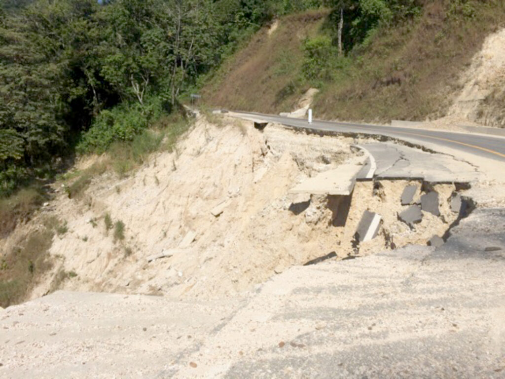
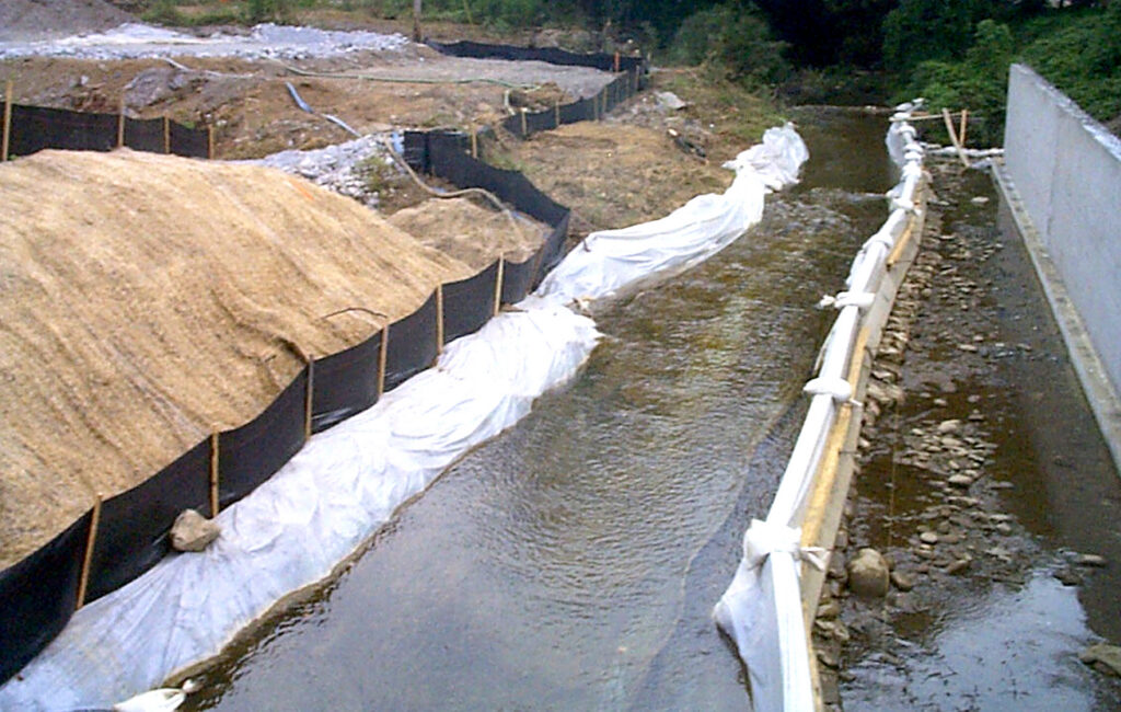
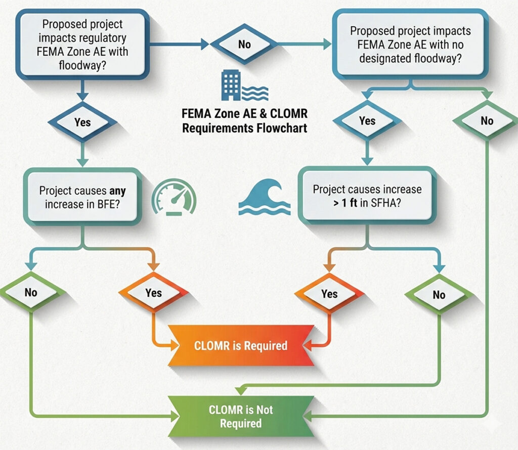
Coordinating with FEMA is a process, not a checklist. Before engaging FEMA, your design must meet all local standards, which can take many months. If a Conditional Letter of Map Revision (CLOMR) or Letter of Map Revision (LOMR) is required, expect the timeline to stretch into years. Depending on the floodplain being reclaimed, the project may also need to secure U.S. Army Corps of Engineers permits, which can also take years to obtain and close out.

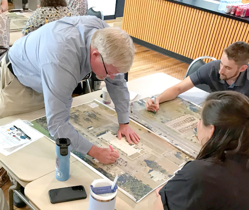
CLOMRs are required by FEMA in certain instances (Fig. 4), but are otherwise considered optional and up to the local floodplain administrator. They may take up to a year to coordinate through FEMA before issuing local permits, and after construction, the LOMR process with FEMA can add another 12–15 months before the flood map is officially updated. Factor this into your project strategy from the outset.

5. Cut and Fill Goes Beyond Volume Balance

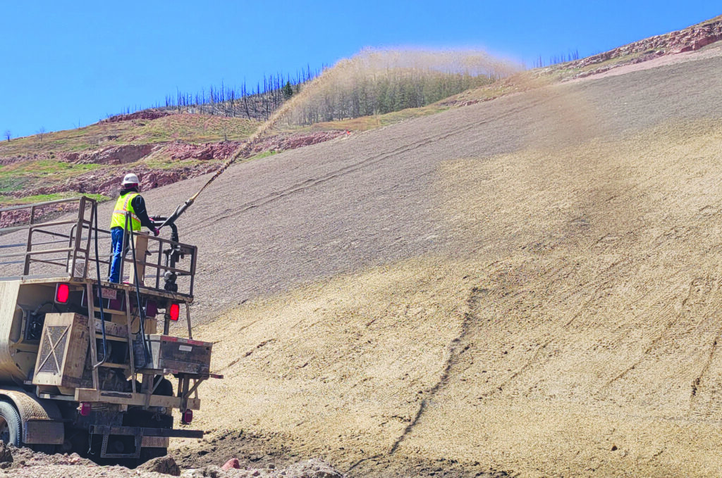
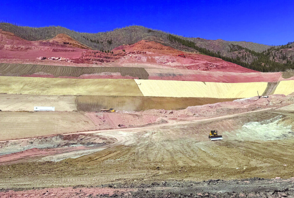
Floodplain reclamation isn’t just a numbers game. While balancing cut and fill volumes looks simple on paper, real-world conditions complicate matters. Cuts and fills should occur within the same hydraulic reach to ensure flood storage is replaced where it functions. Excavated areas must connect hydraulically and activate during flood events, not become isolated depressions. Compaction requirements are stricter, construction sequencing is more limited, and erosion and maintenance risks are higher. A practical tip: Overexcavate compensatory storage slightly to account for future sedimentation and vegetation growth.

6. Let Water Do What It Does Best

Equal conveyance means preserving the natural flow of water through your site. Problems arise when flow paths are blocked by building pads, roads, or fills that prioritize convenience over hydraulics. These issues may not show up in minor storms, but they may become critical during major flood events. Successful designs maintain predevelopment flow paths and account for both minor and base flood conditions.

Pay special attention to transitions between channels and floodplain areas, where velocities and water surface elevations can change rapidly. In modeling, clear and logically spaced cross-sections that reflect actual site conditions are more effective than overly complex models.

7. Velocity and Stabilization: Protect Your Investment

Even with proper floodplain storage and conveyance, unmanaged changes in water velocity can undermine a project. Localized velocity increases often occur near culvert outlets, channel realignments, floodplain tie-ins, and roadway crossings. Stabilization measures should match the hydraulic demands of each location; overarmoring increases costs and maintenance, while understabilizing invites erosion and regulatory headaches. The best solutions combine targeted hard armor where needed with soil stabilization, revegetation, and grade control elsewhere, always considering long-term maintenance.

8. The Most Defensible Designs Win

FEMA reviewers and local floodplain administrators aren’t looking for clever solutions; they want defensible ones. Successful submittals include clear before-and-after exhibits; transparent volume and conveyance accounting; and consistent assumptions across models, drawings, and narratives. Designs that are simple to explain and logically structured are more likely to move smoothly through review. Conservative assumptions and thorough documentation can reduce review cycles and shorten approval timelines.

Developing land near a floodplain is more than meeting minimum regulatory criteria. It requires stewardship, resilience, and protecting your project and the surrounding community. Integrate hydrology and hydraulic considerations early, and FEMA floodplain reclamation can unlock land value responsibly and efficiently. Treat floodplain issues as an afterthought, and they will become sources of cost, delay, and frustration. For developers and engineers, the path to success is paved with informed decisions, practical strategies, and respect for the dynamic systems at play.

About the Expert

Thomas Caffarel, PE, CFM, is principal and head of engineering at Cardinal Strategies LLC, a global stormwater compliance management firm based in Wylie, Texas.

Train Together for Smarter Stormwater Management

Fig. 1–2: Participants viewed interactive silt fence and inlet protection demonstrations at the 2025 workshop.

REGULATIONS AND BEST MANAGEMENT practice (BMP) manuals aren’t enough to guarantee proper implementation of stormwater management. Siloed agencies, inconsistent understanding, and limited training opportunities create barriers that technical guidance alone can’t overcome. While professional associations and academia offer thorough technical training, that training often overlooks the practical, on-the-ground challenges field professionals face daily.

For the past decade, the Auburn University Water Resources Center (AU–WRC) has addressed these gaps by partnering with municipalities, nonprofits, and organizations across Alabama to deliver interdisciplinary, regionally tailored training programs. The trainings, covering topics from BMPs and stream restoration to low-impact development, are developed alongside local partners, not for them. A collaborative approach ensures that training content reflects regional priorities, local soil and climate conditions, and the specific challenges each community faces.

Why Interdisciplinary Trainings Work

Bringing together city engineers, contractors, consultants, regulators, and nonprofit leaders creates measurable benefits, including:

  1. Building long-term professional networks. Locally developed trainings address knowledge gaps, grow industry capacity, and create opportunities for experts and vendors to share field-tested experience.
  2. Breaking down silos. When stakeholders who work on the same projects in different roles get together, “us vs. them” mentalities dissolve. Familiarity builds collaboration, and people are more likely to reach out for clarifications during design or construction.
  3. Acknowledging geographic differences. Regional use cases give professionals the confidence to implement novel technologies and BMPs suited to local conditions.
  4. Distributing funding and planning responsibility. Cities, counties, nonprofits, and academic institutions often allocate funding for education. Pooling resources helps stretch local training funds.
  5. Fostering a cultural shift toward collaborative problem-solving. Executed effectively, trainings position all participants as partners, not adversaries, in watershed health and regulatory compliance.
Fig. 1–2: Participants viewed interactive silt fence and inlet protection demonstrations at the 2025 workshop.

Building a Planning Team

Successful trainings start with the right people at the planning table. They should include:

  • City and county personnel. These contacts identify local needs, regulatory requirements, and political priorities. Connect with MS4 compliance, engineering, planning, and public works staff to understand the most pressing issues.
  • Universities. Departments in civil and environmental engineering, biosystems, and natural resource planning provide technical expertise and neutral convening spaces. University extension networks and campus project sites can showcase living labs for green infrastructure and restored streams, while also offering continuing education credits.
  • Contractors and builders. Field-based perspectives reveal constructability challenges, sequencing issues, costs,
    and zoning barriers designers might
    not encounter.
  • Consultants and designers. These professionals bridge regulatory codes, modeling requirements and BMP design realities, offering valuable case studies on local barriers and solutions.
  • Inspectors and enforcement staff. A regulatory presence enables joint field inspections of exemplary and problematic installations plus collaborative development of inspection checklists and photo guides.
  • Nonprofit and environmental organizations. Local organizations are well-​connected to the community and ongoing projects. Including them in trainings extends an often-hidden view of how the BMP design process works and ways to plan more effectively with diverse partners.

Elements of a Successful Training

To ensure a successful training, form a core event-planning team at least four months out from the proposed event. Four months should be sufficient to allow members to determine a topic based on regionally identified needs, establish budgets and sponsorship parameters, assign partner roles, secure dates and venues, recruit speakers, finalize the agenda, launch registration, develop marketing materials, and hold regular check-ins leading up to the event.

Plan sessions collaboratively to set clear goals. Select topics and case studies that are local or regional and address current community priorities. Build discussion and networking time into the agenda. When feasible, include field tours or hands-on demonstrations; they require coordination but deliver measurable impact.

Real-World Examples

Erosion and sediment control (ESC). As development pressures mounted in Baldwin County, Alabama, local municipalities recognized a need for improved erosion and sediment control BMP implementation. The City of Fairhope, AU–WRC, the Mobile Bay National Estuary Program, Baldwin County, and the City of Daphne collaborated to deliver a hands-on workshop covering Alabama’s ESC design guidance, inspection requirements, and BMP options.

The event culminated in a field visit to an active construction site where participants observed inlet protection, silt fencing, deflocculation, and vegetation establishment demonstrations from the Auburn University Stormwater group and the Alabama Erosion and Sediment Control Partnership. More than 70 attendees, municipal staff, consultants, nonprofit representatives, and academics participated. Sponsorships and partner fund pooling kept costs low, and Auburn University offered continuing education units for participants.

Stream restoration technology. AU–WRC, the Mobile Bay National Estuary Program, and Baldwin County hosted a one-day workshop in Spanish Fort featuring case study presentations and site visits. Speakers discussed project initiation, design, and construction, sharing lessons learned from stream restoration projects across southern Alabama. Discussion covered restoration vegetation, contractor perspectives, assessment techniques, and hydrologic modeling. Sponsorships and grant subsidies kept the fees low, and Auburn University offered CEUs. Participants included municipal leaders, engineers, landscape architects, consultants, and environmental nonprofits.

Designing bioretention. On April 20, 2023, Auburn University hosted a workshop bringing together the Cities of Auburn and Opelika to showcase how municipalities design, install, and fund green infrastructure projects. Using a “learn with us” approach, the workshop featured case studies and a site visit to Auburn’s H.C. Morgan Water Pollution Control Facility.

Participants included municipal planners and engineers, environmental consultants, riverkeepers, master gardeners, and state agency representatives. The workshop was part of a larger National Fish and Wildlife Foundation Five Star Grant initiative, “Leveraging Infrastructure Funding to Promote Stewardship” in Auburn, Alabama, which involves AU–WRC, the AU Bee Laboratory, Lee County Girl Scouts, and Westervelt Ecological Resources.

Nature-based stormwater solutions. AU–WRC and the Mobile Bay National Estuary Program hosted a two-day workshop in which participants learned about green infrastructure from a project manager with the City of New Orleans, which has a mandate to integrate green infrastructure into new site designs to reduce flooding.

Practitioners; municipal staff; and representatives of local and regional government, nonprofits, and state agencies reviewed a range of case studies and project funding options before exploring two city-owned properties in Baldwin County to consider how nature-based stormwater solutions might be applied. On Day Two, participants worked in teams to develop integrated stormwater plans for each site. CEUs were offered, and cost-sharing kept the event affordable.

Participants illustrated their visions for nature-based stormwater solutions on practice sites at the 2023 workshop.

The Power of Presence

Effective erosion and sediment control doesn’t mean perfect BMPs on paper; it’s about having the right people in the same room, learning how to make practices work on the ground. When city engineers sit next to contractors, when regulators dialogue with developers, and when university researchers share their findings with field professionals, something shifts. Trust builds, solutions emerge, and watersheds benefit. Interdisciplinary trainings can do more than transfer technical knowledge; they can transform how communities approach water management.

About the Expert

Laura Cooley is an outreach project manager with the Auburn University–Water Resources Center and provides leadership on environmental planning, decision-making, and restoration initiatives involving multiple agencies. She facilitates trainings in green stormwater infrastructure and watershed planning.

Putting Down Roots

Hardy vetiver grass proves useful for erosion control in southern Oaxaca, México

OAXACA IS THE FIFTH-LARGEST state in México, the country’s first in cultural and biological diversity, and home to 14 distinct indigenous peoples and 23 distinct languages (Fig. 2). It is approximately the size of Portugal and almost twice the size of Costa Rica. It contains 80% of the vegetation types present in México (more plant diversity than Europe), and its climates range from semi-desert to tropical rain forest. Much of Oaxaca’s original forest is intact.

Oaxaca is a Spanish adaptation of the náhuatl word Huāxyacac—a name imposed by the conquering Aztecs that means “place where the huaje tree (Leucaena leucocephala) grows.” The state is mostly mountainous and experiences serious erosion problems resulting from land use conversions including road cuts, fill slopes, new construction, cultivation, grazing, and timber harvesting (Figs. 3–5).

Most of the state has two seasons: rainy and dry. During the rainy season, heavy rains exacerbate erosion problems. Most of the land development addressed in this article has been completed at the municipal or local level, while the federal government in México City is responsible for developing and maintaining the federal highway system.

Long-term source control at the local level is often inadequate, requiring repeated repairs and maintenance. Slope failures occur on a continuous basis due to poor engineering and lack of proper drainage assessments, especially along road cuts. Some sections of road are rebuilt year after year; cuts often go ignored, with eroded and unconsolidated material pushed over to the fill slope.

The typical hard-​engineered erosion control methods implemented in Oaxaca include gabions, rock fall netting, geotextiles, and concrete. Underappreciated and rarely used are biotechnical (vegetative) methods, alone or in combination with other structural solutions.

A Potential Biotechnical Solution

Vetiver is a tufted, fibrous, deeply rooted, and fast-​growing perennial grass native to southern India. It has been used for biotechnical engineering and erosion/sediment control for decades. The genotypes in circulation don’t produce seed or don’t produce viable seed.

Due to its non-stoloniferous, non-rhizomatous root structure and lack of seed production, the vigorous and highly adaptable plant is noninvasive. Vetiver therefore poses no threat to native plant communities and can contribute to their natural reestablishment.

Vetiver’s stiff leaves and stems provide a perfect barrier to sediment while established roots (up to nine feet) act as a subterranean retaining wall and stabilize slopes, providing both erosion and sediment control. It can be used by itself or in conjunction with other methods, such as rock, gabions, and geotextiles. In many applications, simple tools such as shovels, ladders, and ropes may be all that’s needed to get it established.

Vetiver grass has been planted extensively worldwide in tropical and subtropical climates and can be found in Louisiana, Florida, and Texas in the United States, where deep freezes don’t occur. It has also been used in Brazil, China, the Democratic Republic of Congo, Australia, Indonesia, Venezuela, Vietnam, Thailand, India, the Philippines, Senegal, Zimbabwe, Nigeria, Colombia, El Salvador, Nicaragua, Guatemala, and Costa Rica. It made its debut in Oaxaca, México, more than 25 years ago.

Growth Characteristics and Adaptability

Soils. Vetiver has a tolerance to a wide range of soil types with pHs ranging from 3 to 11. It thrives in a variety of soil textures, from coarse gravel to decomposed granite to fine and shifting sands to clay. It can grow in saline and sodic soils, soils with very high manganese and aluminum content, and soils with high concentrations of heavy metals.

Moisture. Although vetiver is hydrophilic and needs watering to establish in dry climates, it can tolerate long periods of drought; its stems die back, but the roots persist. In a climate that has two distinct seasons (drought and rain), it’s best to plant vetiver about a month before the rainy season starts if regular watering or irrigation isn’t feasible. It can also tolerate prolonged periods of inundation.

Shade. Vetiver is not shade-tolerant. This can be advantageous if used as an erosion control “nurse” crop, with the natives colonizing after stabilization has occurred, shading out the vetiver plants.

Other characteristics. Vetiver has an ability to repel pests thanks to compounds such as nootkatone in its roots. The oils repel ants, ticks, and termites. The plant can control the larvae of stem borer corn moths and inhibit destructive nematodes. Field investigations show that vetiver barriers planted around corn can act as a reservoir for beneficial insects.

Vetiver’s coarse fibers can be woven into baskets, and its leaves can be used as an alternative to palm fronds for thatched roofs (palapas). The roots are fragrant, and the plant’s essence, often called false patchouli, is an ingredient in the well-known perfume Chanel No. 5. Vetiver can be made into wreaths or planted and pruned as an ornamental hedge.

Vetiver can be planted in rows along flow lines to direct or concentrate runoff instead of enhancing infiltration. It is mycorrhizal, and its roots can serve as a source of inoculants in soils lacking spores or hyphae. Vetiver is effective for phytoremediation, wastewater treatment, and wetland restoration where water quality has been compromised. Research carried out by Dr. Paul Truong shows that absorption by the vetiver plant can dramatically reduce pollutants.

Installation. Tillers (Fig. 6) are typically used on slope stabilization projects. Since vetiver does not spread by the roots, tillers need to be closely spaced, +/-6 in apart (+/-15 cm). Only a shallow ditch is needed—4 to 6 inches (10 to 15 cm) in depth and 4 in. (10 cm) wide. Trenches should be prewatered and tillers placed so that the crowns of the plants are flush with the soil surface, back-filled with moist soil, and watered until the tillers are well rooted.

This work and publication was conducted in collaboration with Larry Woelfel (Bahias de Huatulco), Roley Nofke (South Africa), Norma Perez (Bahias de Huatulco), Leslie Yerrington
and Barry Logan (Pluma Hidalgo), and Larry Turk (Reno, Nevada). For more information, visit vetiver.org.

Frequency and volume of irrigation will vary with climate, aspect, soil type, and season. Once established with several feet of stem growth, the stems can be cut close to the crown to encourage new tillers to reproduce laterally. Stems can be used as mulch and bundled into fascines (Fig. 7).

On-site in Oaxaca

In 2013, WBS purchased a box of bare-root vetiver tillers from Benemérita Universidad Autónoma de Puebla (Fig. 8) and reinitiated its use along the coast by establishing several small nurseries and projects. The intent was to increase vetiver’s use through broader distribution and education.

Small projects were implemented in 2013, and training workshops began in 2015 on steep slopes at small organic farms and in the coffee-growing region of Pluma Hidalgo. Pluma is an area that has been inhabited relatively recently, and it suffers from severe slope failures that result in property loss, road closures, decreased productivity, and almost constant road repairs.

Rural Schools

Since 2020, 10 projects have been completed, many benefiting rural schools. In Puente Todos Santos, schools tend to stand on donated land and have small footprints that lead to steep cuts and fills. Stabilization is typically an afterthought.

Recycled tires are a common erosion control method; they can be backfilled and planted with vetiver and other horticultural species. Watering was necessary for establishment at these sites, since the projects were implemented in the dry season. Training workshops in 2021 and 2023 allowed additional plantings at the top of the fill slope.

Small Organic Farms

Government-supported programs assisted two ranchos (small farms) to develop organic produce through SEMARNAT (Secretaría de Medio Ambiente y Recursos Naturales, or Secretary of the Environment and Natural Resources) with sustainable projects.

Two small farms of approximately 3.5 acres (1.4 ha) each received planting support. One farm planted vetiver hedgerows in newly cleared fields; the more developed site got top-of-slope vetiver erosion control plantings and hedgerows. Both farms had supplemental irrigation available through wells and gravity flow. Additional assistance included the establishment of compost piles for soil enrichment and planting seedling flats with organic seed.

Additional Parcels

On the steep slopes of Pluma Hidalgo, tillers were planted at the top of a cut slope in an effort to prevent slope failure and the loss of limited cultivable property. The fill slope is approximately 2:1 and the cut is vertical; in addition to planting and irrigating to allow for plant establishment prior to the rainy season like the two rancho plantings, fascines were tied with vetiver stems and placed in the trenches behind the tillers. On the lower fill slope, the fascines were intended to support the back wall of the trench, while on the upper slope, they served to increase infiltration.

Montecito. At a luxury development of high-end houses overlooking the Pacific Coast, the developer chose to use vetiver to stabilize 2:5:1 fill slopes instead of a hard engineering solution such as gabions, terraced retaining walls, or concrete. Highly successful technically, the installation also resulted in substantial savings for investors and developers. No erosion has been noted since installation.

Fig. 8: Projects at rural schools and ranchos helped establish vetiver for erosion control.

About the Expert

Julie Etra, MS, CPESC, is president of Western Botanical Services (WBS) Inc. in Reno, Nevada.

Rebuilding a Resource

Texas DOT’s enhanced Interactive Approved Product List takes the guesswork out of specification

IN THE 1980S, THE Texas Department of Transportation (TxDOT) didn’t have a consistent, statewide evaluation program for erosion control products. Only two products met the standard specifications for erosion control blankets, and others were excluded from bids due to material-based requirements. To address these limitations, the agency explored alternatives that would establish a fair, performance-based system for selecting and specifying erosion control products.

In 1993, TxDOT transitioned from material specifications to performance-based standards. The shift marked the beginning of a formal performance testing program, implemented through an interagency contract between the State of Texas and the Texas A&M Transportation Institute (TTI) Sediment & Erosion Control (SEC) Laboratory.

Products approved for use by TxDOT were evaluated at the TTI SEC Lab and confirmed to meet TxDOT soil-loss thresholds and vegetation establishment requirements before being placed on the TxDOT Approved Products List (APL).

Starting in the mid-1990s, the APL existed as a static document, hosted online but updated only when products passed TxDOT thresholds. Listings were organized alphabetically and by basic filters such as slope and soil type, which often required end users to conduct additional research to obtain detailed product information. Furthermore, users couldn’t compare performance data from TTI’s SEC Lab evaluations, limiting the list’s utility.

To address these limitations, TTI launched the Interactive Approved Products List (IAPL) in 2021. The interactive, web-based tool identifies products approved for TxDOT use and enables designers, engineers, and other stakeholders to filter selections based on site-specific conditions. Initially developed in Tableau—a platform designed for visual analytics—the IAPL quickly grew in complexity. More products and filtering capabilities were added, and a need emerged for a more robust, scalable solution.

A New Database Debuts

In 2025, ITT rebuilt the IAPL completely using the Shiny for Python application to offer enhanced flexibility, efficiency, and creative functionality. The updated platform offers faster performance, mobile-friendly access, real-time updates, and an intuitive user interface designed for ease of use in field and office environments—wherever the selection of appropriate erosion and sediment control products is needed.

Key filtering capabilities include:

  • Product application. The IAPL’s first filter allows the end user to sort by the two main erosion control product applications: slope or channel protection.
  • Product type. This filter sorts for hydraulic erosion control products (HECPs), rolled erosion control products (RECPs), and hydromulch for seeding, aligning with corresponding TxDOT standard specification item numbers.
  • Slope and soil type. An end user can specify site conditions such as slope ratios (e.g., 2:1, 3:1, 4:1) and soil classifications (clay, sand).
  • Desired longevity. Based on definitions provided by the Erosion Control Technology Council, an end user can sort products that meet specific longevity requirements—for example, up to 12 months.
  • Shear stress. When selecting a channel erosion control product, the end user can filter for products approved under specific shear stress conditions, ranging from 2 pounds per ft2 (95.76 pascals) to 8 pounds per ft2 (383.04 pascals), ensuring suitability for anticipated hydrology.
  • Wildlife-friendly options. If a design engineer needs to meet certain wildlife standards, users can select products that minimize wildlife entrapment risks according to the U.S. Fish & Wildlife Service.

The IAPL’s data architecture was also modernized in 2025 using the Flask framework for Python, which facilitates immediate publication of new product approvals and streamlined coordination between TTI and manufacturers. This upgrade improves data organization and facilitates updates on product photos, web links, and name changes, saving time and reducing administrative burdens.

TTI is now collaborating with TxDOT to expand the IAPL to include sediment control products. Current research focuses on establishing performance thresholds for these products, which are evaluated for parameters such as change in flow rate, turbidity, and total suspended solids. Categories tested at the TTI SEC Lab include Concrete Approach Drop Inlet, Curb Inlet Protection, Perimeter Protection/In-Stream, and Soil Approach Drop Inlet. The TTI SEC Lab can also test dewatering bags and turbidity curtains, which may be added to the IAPL in the future.

Silt fences approved by TxDOT will soon be included on the IAPL, though TxDOT approves silt fences based on material rather than performance specifications. A dedicated sediment control tab is available on the IAPL for users to reference what products have already been tested.

Although developed for TxDOT’s APL, the IAPL website is publicly accessible and a valuable resource for private-sector engineers, contractors, and designers seeking performance-​based product information. While the IAPL reflects TxDOT standards, users should be aware that other states
may maintain their own approved product lists with different performance criteria
and specifications.

Access the TxDOT IAPL here: iapl.tti.tamu.edu/iapl.

About the Experts

Joshua Bell is a research specialist II at TTI’s Sediment and Erosion Control Lab. He has expertise in water quality, vegetation establishment, and product performance testing.

Jett McFalls is a research scientist at TTI’s Sediment and Erosion Control Lab. He has led numerous vegetation and water quality studies as principal investigator and has served actively on IECA subcommittees since joining the association in 1990.

How to Protect Downstream Water

How to Protect Downstream Water

PRETTY MUCH EVERYTHING CONTRACTORS do to minimize erosion and capture sediment on a construction site in Alabama is done to protect the receiving water downstream—in many cases, a small stream or creek. Why is it so important to protect these streams?

Sediment degrades aquatic habitats, and turbidity restricts light and aquatic plant growth. This disrupts the food chain and impairs fish and aquatic insect populations. Suspended sediment reduces visibility and affects fishes’ ability to feed and breathe, making the habitat favor pollution-tolerant species such as carp and suckers over sportfish such as bass and bream.

Finally, sediment carries pathogens, nutrients, and toxic materials such as heavy metals and chemicals into waterways. Such pollutants affect drinking water and surface water quality, contributing to higher water treatment costs, fish consumption advisories, and oxygen-depleted (anoxic) zones. These are commonly known as “dead zones” in the Gulf of Mexico.

Minimizing erosion on a construction site must follow a few simple principles:

  • Minimize bare soil areas and the time bare soils are exposed;
  • Slow runoff water so that soil particles are not detached and transported offsite;
  • Vegetate at every opportunity; and
  • Keep the clean water that enters a construction site clean.

Crews can install practices that capture sediment by:

  • Slowing or “ponding” runoff to allow coarser soil particles to settle;
  • Allowing time for smaller suspended soil particles to settle;
  • Using flocculants to bind sediments and limit turbidity; and
  • Using barriers and other common sediment control practices.

While most of our erosion and sediment control practices protect the stream downslope of a project, there are some that have more immediate effects.

Temporary Stream Crossings

Many construction sites (especially linear projects) have streams that traverse a project, and it is important to keep their water clean by avoiding the introduction of sediment or turbid runoff. To prevent construction equipment from crossing a stream bed or damaging the stream channel and banks, use a temporary stream crossing.

Temporary bridges are often the best alternative; they can be used to allow construction equipment to cross with minimal effect on the aquatic environment (Fig. 2). The opening under the bridge should be designed to convey the runoff from at least a two-year, 24-hour storm if no other parameters are specified.

Stream Diversion Channels

Streams that cross projects may also be contained within a large culvert or bridge as part of a construction project. A stream diversion channel can be used to bypass the stream through the project while construction is underway (Fig. 3). It is important for the stream diversion channel to be sized properly to safely pass the bank-full capacity of the existing stream.

To minimize detrimental effects to the environment and the aquatic community, a stream diversion channel should be installed quickly and carefully, maintained well, and removed as soon as possible after the construction area is stabilized. Plan and install a stream diversion channel in a manner and timeframe—dry season—that minimizes impact to fisheries and the aquatic environment. Specify a sequence of construction in the contract work.

When culvert installation is part of a project, remember that there might be aquatic organisms that need to travel drainageways even in intermittent streams. If your culvert outlet has a minimal overfall, small aquatic animals could be blocked from the migratory paths needed to sustain their lifecycles (Fig. 4). Consider using larger culverts that are placed to avoid overfalls, bottomless culverts that allow for the stream bottom to cross under the roadway, or even a small bridge.

Stream Bank Protection

Stream banks inside a project or downstream of a project often become unstable and need attention to keep mass erosion from occurring. Stream bank protection may be vegetative, structural, or a combination of the two. Consult a design professional to design a stable stream bank and stream.

In my experience, the toe or bottom of the stream bank must be stabilized for the entire bank to be stable. When the toe of the slope gets undermined due to erosion, the stream bank will usually fail.

Buffer Zones

Finally, think about the buffer or riparian zone area next to the stream and concentrated flow areas. Vegetated buffers provide stream bank stability, reduce scour erosion, reduce storm runoff velocities, remove some sediment from stormwater, and provide flood storage. Protecting, enhancing, and maintaining these areas provides a buffer between landscape changes and the living waters.

Concentrated flow areas in the landscape can be anything from a roadside ditch to a river. The land adjacent to the concentrated flow areas needs vegetative cover; riparian areas provide the last line of defense against nonpoint source pollution from entering stream waters.

There is no justification for spraying roadside ditches and stream banks with herbicides—or worse, diesel fuel—to kill vegetation (Fig. 5). Make it a central point in your daily routine to help others understand the importance of the natural “living filter” vegetation provides around concentrated flow areas.

It isn’t difficult to protect streams from the erosion and sediment that might leave a construction site—put forth the effort and remember that you can’t just do things “the way you’ve always done them.” You can instead choose a new or different strategy to accomplish the job and protect the environment.

Many of these concepts are captured in the “Erosion and Sediment Control Tips” section of the Alabama Soil and Water Conservation Committee’s blog. Scan the QR code to visit the site and learn more.

About the Expert

Perry L. Oakes, PE, is erosion and sediment control program coordinator for the Alabama Soil and Water Conservation Committee and the former state conservation engineer for the USDA–Natural Resources Conservation Service in Alabama.

The Future of IECA

Samantha A. Roe, IOM IECA Chief Executive Officer

AS THIS ISSUE OF Environmental Connection reaches you, many of us have returned from Fort Worth energized, inspired, and reminded of why IECA matters so deeply to our profession.

Conferences give us a moment to pause and reflect. What stays with me after Fort Worth is not just the strength of the education or the vibrancy of the Expo Hall, but the clarity about where the International Erosion Control Association is headed. IECA is entering a new chapter—one defined by connection, relevance, and global alignment.

Over the past several years, we have laid important groundwork to position the association for the future. We have invested in modern systems, refreshed how we present ourselves to the world, and strengthened the infrastructure that supports our members. These efforts are intentional and strategic; they allow us to move forward with confidence rather than simply respond to change.

Looking ahead, our focus is clear: IECA will continue to be the trusted global leader in erosion and sediment control, stormwater management, and environmental protection. That leadership will be reflected not only in the technical excellence of our education and certification programs, but also in how we connect members across regions, disciplines, and generations.

The future of IECA is collaborative. Environmental challenges don’t stop at borders, and neither can our solutions. As a unified, global organization, we are better equipped to share knowledge, elevate best practices, and support professionals wherever they work. This global perspective strengthens every local chapter and every individual member.

The future of IECA is also innovative. We will continue to expand learning opportunities, explore new ways to deliver content, and leverage technology to make engagement easier and more meaningful. Our goal is simple: Membership in IECA should add clear, tangible value to your professional life.

Equally important, the future of IECA is grounded in people. Our volunteers, chapter leaders, instructors, and staff are the foundation of this organization. Their expertise, generosity, and commitment drive everything we do. As CEO, one of my priorities is to ensure that IECA remains an organization where leaders are developed, contributions are recognized, and diverse voices are welcomed.

The Fort Worth conference was an important milestone, not a finish line. It was a moment of alignment and momentum. What comes next is continued growth, thoughtful evolution, and a shared commitment to advancing our profession. Thank you for your engagement, your trust, and your belief in what IECA can be. The future is being built now, and I am excited to continue shaping it together.

Samantha A. Roe, IOM

Chief Executive Officer, International Erosion Control Association (IECA)

Reclaiming ‘The Scar’

A reclamation project is taking “ to future recreational site.

By Rachel Reynolds, CPESC, CESSWI 

ELEVATED ABOVE COLORADO SPRINGS, Pikeview Quarry stands out as a historic landmark. For more than a century, it supplied more than half of the limestone that built the city. From 1903 to 2018, workers carved out the mountainside and left a 125-acre (50.6 ha) gash locals refer to as “The Scar.” 

After a series of slope failures forced the mine’s permanent closure, the Colorado Division of Reclamation, Mining, and Safety (DRMS) launched reclamation efforts. The goal? To transform a longstanding industrial landmark into a community asset. 

The project would proceed in three phases. First, reclaim the land through grading and stabilization. Next, restore the ecological function of the mountainside through soil and revegetation efforts. And finally, re-create the site as a public area for residents.

The site posed significant environmental and engineering challenges. Not only did workers need to account for high elevations and near-vertical slopes, but a century of mining had left the soil denuded. With careful design and advanced erosion control, however, the project is on the way to reclaiming the large-scale site through data-driven best management practices. 

Phase One: Reclamation Through Stabilization 

In the first phase of the project, workers needed to regrade the quarry to stabilize the mountainside and prepare the terrain for revegetation. Crews moved approximately 565,000 cubic yards (16,000 m3) of structural material, and earthwork included four miles of channel construction and riprap placement. Once complete, workers had prepared roughly 127 acres (51.4 ha).

Workers opted to drill seed during this stage to maximize seed-to-soil contact. Depending on land ownership, crews applied two different seed mixes: a permanent native mix for erosion control on private surface lands, and a seed mix specified by the U.S. Forest Service (USFS) elsewhere. To accommodate the semi-arid climate, all seed was supplied already coated with endomycorrhiza and ectomycorrhiza fungi, which form symbiotic relationships with plant roots to increase nutrient uptake and water retention. Endomycorrhizae help protect grass seeds, while ectomycorrhizae aid tree development. 

Phase Two: Restoration Through Revegetation

The restoration phase focused on revegetation to transform “The Scar” into a lush landscape. Laboratory soil testing provided using Profile’s Soil Solutions Software (PS³) reflected poor conditions, including an average soil pH of 8.2, organic matter content of 0.4%, and high concentrations of soluble salts up to 5.59 dS/m—far from the ideal conditions of 6.3–7.3 pH, organic matter above 5%, and soluble salts less than 0.75 dS/m. The team determined that amending the soil would be essential for successful revegetation.

The quarry’s topography also introduced challenges. While some slopes were on gradual inclines less than 3H:1V, other areas were near-vertical. Recognizing that no single approach would work across the entire site, the team customized erosion control solutions for each section of “The Scar.” Timing was equally unforgiving, with just 10 weeks between grading and the onset of monsoon season to seed the site, apply soil amendments, and install erosion control materials.

Initial specifications called for applying topsoil, but that can bring inconsistent quality, higher costs, and greater labor risks, especially on steep terrain. Workers instead developed a new custom erosion control and revegetation plan that included applying biotic soil technologies—engineered organic growth media designed to revitalize the denuded soil—and a combination of hydraulically applied erosion control products and erosion control blankets to hold seed and soil in place. 

Fig 1: The team used hydromulching as a safe and efficient method for applying biotic soil tec
hydraulically applied erosion control products.

For slopes with grades of less than 3H:1V, the contractor applied ProGanics DUAL, an all-in-one soil health and erosion control product. The product spurs the nutrient cycling necessary to improve soil health for sustainable vegetation establishment, while a bonded fiber matrix effectively locks down and protects seed and soil. The one-step, hydraulically applied solution is ideal for such site conditions, especially when application windows are tight. The product was applied at a rate of 5,500 pounds per acre (6,164 kg/ha).

On slopes greater than 3H:1V, the contractor hydraulically applied a biotic soil media from Profile Products to amend the soil blended with FlocLoc polyacrylamide flocculating soil stabilizer, BioSol slow-release fertilizer, humates, and an organic fertilizer at a rate of 3,500 pounds per acre (3,923 kg/ha). Workers then installed a biodegradable, wood-based Excelsior erosion control blanket for additional protection without introducing plastics to the environment. 

On the near-vertical slopes, the contractor applied biotic soil media and soil amendments to introduce soil-​building components. Workers topped the site with Profile’s ProMatrix EFM—a hydraulically applied erosion control product that provides protection up to a bonded fiber matrix—at 3,500 pounds per acre (3,923 kg/ha). 

Within a few weeks of application and aided by late-summer monsoon rains, vegetative growth started to turn the once-barren site green and wildlife returned to the area. The combination of carefully selected seed mixes, soil amendments, and coordinated erosion control solutions brought life back to the slopes. “The Scar” was healing. 

Fig 1: The team used hydromulching as a safe and efficient method for applying biotic soil tec
hydraulically applied erosion control products.
Fig. 3: The project used DUAL, an all-in-one biotic soil media and erosion control application.

Phase Three: Re-Create for Future Use

Once DRMS confirms the successful establishment of vegetation and slope stability after two years of sustained vegetative growth, it will release the site from active mining permits. Castle Aggregates will transfer the property to the City of Colorado Springs, which plans to develop a mountain bike and recreation park overlooking the city. Now—more than a year after application—the site has continued to support vegetation and is on its way to being released. 

The project demonstrates that large-scale reclamation is possible through prescriptive, innovative, and collaborative solutions. What was once an environmental blemish is now experiencing rebirth and growth. With integrated erosion control systems and vision, even the most daunting mine reclamation sites can be brought back to life. 

About the Expert 

Rachel Reynolds, CPESC, CESSWI, is regional business manager for Profile Products. She can be reached at rreynolds@profileproducts.com

IECA and the Emerging Leaders Alliance

Each year, IECA sponsors seven industry professionals to attend the ELA Conference. Photo Credit: Applied Polymer Solutions

Conference helps participants grow as leaders through immersive sessions, collaboration, and workshops

By Jacob Burkey

IN TODAY’S FAST-PACED, COMPLEX world, leadership in engineering and science is more critical than ever. The Emerging Leaders Alliance (ELA) is a unique opportunity for rising erosion control and stormwater professionals to develop the leadership and interpersonal skills needed to lead teams, drive innovation, and shape the future of their industries. 

ELA was founded in 2008 as a cooperative initiative between several engineering organizations that saw a common need to cultivate leadership in the engineering and scientific communities. It is currently supported by the following partners:

  1. International Erosion Control Association (IECA)
  2. American Concrete Institute (ACI)
  3. Association for Iron & Steel Technology (AIST)
  4. Society for Mining, Metallurgy & Exploration (SME)
  5. The Minerals, Metals & Materials Society (TMS)
  6. Society of Petroleum Engineers (SPE)

Leadership is more than management, however. It’s the art, science, and craft of influencing people to accomplish tasks and improve organizations. ELA helps participants understand and embrace this broader definition through immersive sessions, peer collaboration, and expert-led workshops.

What IECA Participants Are Saying

IECA sponsors seven professionals to attend the ELA conference each year. Here is what recent attendees said about their experience: 

“Before the conference, I didn’t really think of what I did as a ‘leadership’ role. After participating in the conference, I realized that my management role is more of a leadership role, and we have to model the behavior we expect our team to follow. I have to be clear and upfront with my team, so they know my expectations on projects. The one skill that I’ve used most since the conference is negotiating. I have to negotiate with people all the time to find appropriate deadlines and project timelines.”

“I really valued the interpersonal session we had about making social networks. As one transitions to a more [managerial] role, a wide social network is needed, and it is hard work building that network. I now leave my office door open and have had a lot more interactions with my coworkers.”

“I was unsure of what to expect from a leadership training, and admittedly a little skeptical. After attending ELA, I now realize how much I didn’t know what I didn’t know. When you hear world-class experts break down topics such as negotiation, feedback, collaboration, conflict resolution, stress management, and public speaking, the topics come to life. They analyzed these ‘soft skills’ in a technical and academic manner that resonated with my own technical background and mindset. I feel like I just received a college course in three days.”

“I found the personality assessment and the management soft skills sections particularly insightful. Regarding networking opportunities, [it was] maybe one of the best experiences I’ve had in my career so far in terms of the group assembled.”

“I really enjoyed getting to know other IECA members on a more personal level. I felt like we got to build a personal and a working relationship with the people in our ELA cohort.”

“I would recommend this conference to other people who have recently transitioned to a management role or have to lead teams. The conference touches on so many aspects of work, work-life balance, networking, and leadership. I enjoyed how they incorporated sessions on (1) giving feedback to different types of personalities; (2) stretches you can do at your desk; and (3) different ways you can network [and] what to talk about when you network.”

“I thought the ELA was one of the more informative and applicable conferences I have attended. One of the big takeaways was how important and beneficial meditation can be throughout the day. It is so easy to get wrapped up in the fast-paced work environment and not take the appropriate amount of time to rebalance yourself.” 

“It was enlightening to engage in the social styles (analytical, amiable, driving, and expressive) exercise to learn how your work colleagues perceive your patterns, strengths, and weaknesses, and see how this can differ significantly from your self-perception. I regularly think about the social styles and tendencies discussed at ELA in my interactions with colleagues and clients, and this has helped me to lead stronger and more effective teams.”

“Over the three-day event, I met and bonded with like-minded individuals across related industries, learned from world-​renowned subject matter experts on a multitude of business-related topics such as stress management and negotiation, and was shown aspects of myself to which I was blind. The event left a lasting impression on me, providing me with a lot of useful information to think about and skills to learn. If you have the opportunity, I highly suggest attending the event.”

Who Should Attend 

ELA is designed for young professionals who are ready to take the next step in their careers. Typically 25–35 years old, they are: 

  1. Employees of industry and government agencies. Rising or current middle managers and technical staff leaders (e.g., associate research consultants, research specialists) with potential for executive or fellow-level roles.
  2. Academics. Professors with six or more years of experience, especially those leading research groups or centers and aspiring to leadership positions such as department chair or dean.
  3. High achievers. Individuals with a strong record of personal and organizational success—published research, awards, promotions, or leading successful teams.
  4. Members of organizations without internal leadership programs. Preference is given to professionals from smaller companies, academic institutions, or government agencies lacking formal leadership development.
  5. International participants. The ELA welcomes global applicants to expand its diverse network.
Why Apply or Nominate?

The ELA is more than a conference—it’s a launchpad for future leaders. Whether you’re stepping into a new management role, leading a technical team, or aspiring to influence your organization at a higher level, ELA provides the tools, connections, and confidence to succeed.

Apply today or nominate a rising star in your organization to become part of a growing network of professionals who are shaping the future of engineering and science: bit.ly/IECA-ELA

About the Expert 

Jacob Burkey is a project manager and water resources engineer at Woolpert Inc. and chair of the IECA Professional Development Committee. He has more than 14 years of experience specializing in stormwater management, erosion and sediment control, post-construction water quality, and environmental monitoring.

Women of Water

women in water: international women’s day

Professional network expands to help more women thrive in the industry

By Kellyn Campbell, CPESC

WOMEN OF IECA GOT its start at the 2015 International Erosion Control Association’s Annual Conference in Portland, Oregon. Beth Chesson, a mentor and consultant with AMEC Environment and Infrastructure, was approached by several female members wondering where women in the industry could connect. 

Grassroots meetings followed annually at conferences, but I felt that women who didn’t or couldn’t attend every IECA event might like another avenue through which they could connect. At the 2017 Annual Conference, I was “voluntold” to take over, and I made it my mission to make Women of IECA a place where female industry leaders could network and exchange ideas every day. 

There was joy in being a part of an initiative that brought women together. But it became clear that there was more to be done, and I found myself leading the charge to expand the community’s reach. That’s why Women of IECA has formed an alliance with Women of Water, a Utah-based organization of women who work in stormwater, wastewater, and water resources. 

Expanding a Network

A dedicated team of women from IECA and Women of Water has been working diligently to lay the groundwork for the future of Women in Water, creating bylaws, drafting chapter documents, and planning a national launch. We are establishing Women of Water as a force in the industry that provides a unified voice and robust support system for women in the sector. 

In 2026, the organization is looking to continue growing Women of Water’s impact by adding more members and new chapters. Our mission is to unite women in the industry by providing a robust support network complete with mentorship opportunities, social events, and educational development. 

Engagement and Empowerment

At its core, Women of Water seeks to engage, empower, and educate women in the industry. Participants can find mentorship, build professional relationships, and develop the skills needed to thrive in the sector. The organization’s programs and resources are designed to support women at every stage in their careers—from those just starting out to seasoned professionals seeking new opportunities for growth.

Virtual events and programs help women connect with one another, share knowledge, and promote professional development at a distance. These can include book club chats, panel discussions, and talks with industry experts. These initiatives allow members nationwide to engage with each other and stay informed on the latest trends, best practices, and challenges facing the water industry.

The Utah chapter also hosts numerous in-person events—usually in Salt Lake City—where women can meet, network, and learn in a face-to-face setting. These events are essential for creating lasting bonds and tangible support for women working in the water sector.

Growing a Movement 

With continued efforts to build chapters and expand the organization’s national reach, the future of Women of Water looks bright. Momentum is building behind our movement, and 2026 will bring Women of Water to new regions across the country, providing even more opportunities for women to excel in the industry.

I have benefited greatly from Women of Water. It has provided me with mentors who helped me navigate career challenges, build my professional network, and grow friendships with the incredible women in IECA. Women of Water gave me the skills necessary to move into a leadership role. 

By fostering a supportive network that encourages mentorship, professional growth, and leadership, Women of Water is helping women excel in the industry, overcome obstacles, and lead with confidence. Women of Water is proving that when women join to support one another, everyone can thrive. 

About the Expert 

Kellyn Campbell, CPESC, is president of Campbell Environmental Supply and Consulting in Spartanburg, South Carolina. 

Meetup Scheduled

During the IECA Annual Conference and Expo, Women of Water will host an event at a woman-owned wine bar in Fort Worth, Wine From a Broad, where conference attendees can meet, share experiences, and build professional relationships. The ticketed event is scheduled for Monday, March 2, at 6:15 p.m. Stay tuned for further information. 

Using Artificial Atolls to Clean Water

Fig. 1: The artificial atolls will support mangroves and oyster beds to filter water naturally. Photo Credit: Earthwerks Land Improvement & Development Corp

Peer Reviewed

By Jonathan Koepke

THE COASTAL HABITAT AND Water Quality (C-HAWQ) Initiative is a nonprofit that’s helping Florida’s coastal communities improve water quality and environmental resilience. C-HAWQ advances this work by conducting primary research, promoting public education, and building solutions focused on the waterways, habitats, wildlife, and water quality of coastal communities.

Municipalities throughout Florida can leverage C-HAWQ’s no-cost, noncommercial model to turn dormant water quality projects into shovel-ready initiatives. The initiative supports partners with free advisory services and up to US$250,000 in direct funding, and it can help access sums as large as $100 million in indirect funding through public-private partnerships.

The organization is also a contributor to scientific dialogue, investing more than $1 million in research grants focused on managing human-made waterways and their ecological impacts. As a boots-on-the-ground partner and a scientific contributor, it shares its expertise with that of a growing network of engineers, contractors, and other partners to propose, plan, and deploy site-specific remedies that promote higher ecological function. 

Marco Island’s Issues

The first project developed by the C-HAWQ team is set to address a water quality issue in Marco Island, Florida. The inland waterways and canals of the small island community extend more than 100 miles, connect its residential communities, and provide direct access to the Gulf of Mexico. 

In 2019, the Florida Department of Environmental Protection (FDEP) listed the waterways of Marco Island as “impaired” after logging excessive nitrogen limits in the previous two years. Areas southeast of Marco Island were also listed as impaired for total nitrogen, total phosphorus, and fecal coliform levels. 

Some of the activities considered a draw for the island community—boating, fishing, and wildlife-related recreation—are being hindered by the degradation in water quality, and conditions will likely worsen without intervention.

A 2021 water quality report drafted by the water resource engineering firm ERD indicated that the primary sources of nitrogen entering Marco Island’s waterways are sediment release (61%–77% of annual nitrogen loadings) and groundwater seepage (15%–30% of annual nitrogen loadings). In an effort to address these issues, the City of Marco Island sought 4e designation from FDEP, indicating that ongoing restoration activities are in place to remedy water quality issues. 

The plan in place outlines a series of mitigation measures recommended by the 2021 ERD report: 

  • Implementation of stormwater best management practices (BMPs);
  • Reclaimed water management/reuse irrigation;
  • Circulation improvement to canals;
  • Continued water quality monitoring; and
  • Septic system management/phase-out.  

These initiatives are important steps in reducing point and nonpoint sources of nutrient loading into Marco Island’s waterways. They do not, however, address the primary source of nitrogen and other excess nutrients into the island’s estuarine waterways—sediments that have been building up since the canals’ construction in the 1960s. 

Considering the similarly degraded adjacent waters outside of Marco Island’s jurisdiction, maintaining the city’s categorization as having Class II waters sufficient for shellfish propagation and harvesting will require additional measures to meet the stringent water quality standards.

Creating Blue-Green Infrastructure

C-HAWQ proposes to improve the impaired water quality in the canals of the City of Marco Island through the application of nature-based or “blue-green” restoration solutions. Nature-based infrastructure solutions use natural ecological processes to improve water quality rather than solely technological, mechanical, or chemical-based processes. 

Research shows that blue-green methods can be reliably effective and provide a variety of benefits while addressing water quality and stormwater management at the lowest overall costs. Blue-green infrastructure solutions are hybrid systems that provide numerous benefits including economic, societal, and environmental improvements around land and watercourses. 

The systems take a multidisciplinary approach to addressing complex and interrelated problems, often taking innovative, nontraditional approaches wherever human development interacts with natural areas, waterways, and water bodies. They provide adaptive systems that benefit human well-​being and biodiversity alike. 

Blue-green infrastructure also incorporates sustainability into design solutions, creating long-lasting and resilient systems that require less long-term maintenance and cost inputs than traditional infrastructure solutions. The blue-green philosophy is a cornerstone of C-HAWQ’s proposal for Marco Island.

Applying Innovative Solutions

C-HAWQ’s plan targets the biggest issues contributing to poor water quality by dredging nutrient-rich sediments and sands from the bottom of the canals and establishing mangrove islands with native vegetation. The ERD report previously recommended dredging and removal of sediments, but that strategy proved too costly to implement. 

C-HAWQ proposes to drastically cut costs by dredging the canals using mechanical rather than hydraulic methods and placing the sand and sediment in human-made islands that can be planted with native mangroves, seagrasses, and other native plants. The reuse of dredged sediment and sand to construct mangrove habitat islands eliminates disposal and trucking costs while sequestering excess nutrients and other pollutants. 

Each constructed mangrove island is surrounded by limestone—an ideal substrate for oyster colonization, which would provide another level of water purification potential. Oyster reefs improve water quality by filtering algae and excess nutrients; once established, the islands and oyster beds will teem with life, providing improved water quality and critical habitats for fish, birds, and other wildlife valued by the Marco Island community. 

The Public-Private Partnership 

The C-HAWQ team identified Earthwerks Land Improvement & Development Corp. as a contracting lead that could help bring the City of Marco Island an unsolicited public-​private partnership (P3) proposal to implement the project.

C-HAWQ’s no-cost, collaborative planning phase covers visioning, stakeholder engagement, feasibility assessments, and preliminary engineering, allowing projects to move quickly from concept to plan. Once a concept is ready, the initiative supports municipalities in securing at least 50% of project funding from outside sources through P3 structures and philanthropic channels.

Under the Marco Island proposal, Earthwerks serves as the general contractor, entering a comprehensive agreement to shepherd the project from beginning to end. The contractor proposes to provide, at its own risk and expense, lobbying on behalf of the City of Marco Island and applying for grants to secure all necessary funding. Before moving to construction, the company will pursue and complete all necessary engineering and permitting. 

Once funding and permitting are complete, Earthwerks will determine the final scope of work and proceed to construction. The estimated construction timeline for Marco Island is two years, plus three to five years of maintenance and monitoring of the artificial island structures to ensure adequate development of the natural habitat. 

The total project cost is estimated at $60 million. The City of Marco Island is now in the process of evaluating the proposal for technical merit before moving forward with an exciting and unique water quality improvement project. For updates, visit chawq.org/marco-island. 

About the Expert 

Jonathan Koepke is president of ENCAP Inc. He has been a stormwater professional for more than 20 years, working with the public and private sectors to construct and implement real-world stormwater BMPs.

MOST POPULAR