Home Blog Page 6

Filter Sock Technology: Bridging the Gap Between Budget and Sustainability

A newly installed stacked Bioworm application on the Lake Michigan, USA, shoreline.
Figure 1. A newly installed stacked Bioworm application on the Lake Michigan, USA, shoreline.

Sustainability Through Innovation
This article is part of Environmental Connection’s mission to help grow the industry by promoting innovative research, products and
technology that meet industry needs through more sustainable approaches. Articles in future issues will continue to provide multiple
perspectives to promote ongoing efforts to protect natural resources.

In the modern world of construction, where budgets are often tight and environmental regulations are growing more stringent, the intersection of cost-efficiency and sustainability has become a challenging but essential frontier. Every dollar spent on environmental compliance is scrutinized – not out of reluctance, but necessity. In most cases, decisions in this space are driven by engineers working to interpret regulatory requirements while balancing the economic interests of their clients.

Typically, the objective is to meet the minimum regulatory requirements in the most cost-effective way possible. This practice, although common, has long dominated how the industry approaches erosion control and stormwater management. Engineers, often under pressure to deliver efficient solutions, look for products and practices that satisfy regulations without adding unnecessary cost burdens. When that balance is struck – compliance without overrun – it’s considered a win-win for the construction and engineering teams.

However, the landscape is shifting. As environmental awareness grows and sustainability becomes not just a buzzword but a societal expectation, the industry is being challenged to think differently. No longer is it enough to simply meet the standard. Increasingly, stakeholders are asking: How can we exceed it? How can we build in a way that protects natural resources not just today, but for the future?

Sustainability, as defined by the Environmental Protection Agency,1 is about maintaining conditions under which humans and nature can exist in productive harmony. It’s about supporting present and future generations by respecting the systems that support life, especially our natural environment. And in the world of construction and infrastructure development, that often means re-evaluating materials, practices and long-standing norms.

Interestingly, the stormwater and erosion control industry was ahead of its time in many ways. Long before “sustainability” became a global priority, this sector had already begun addressing one of the most pressing environmental challenges: keeping pollutants out of our waterways. Through innovations in design, improvements in best management practices and strict maintenance protocols, the industry has worked tirelessly to reduce runoff, trap sediments and protect aquatic ecosystems.

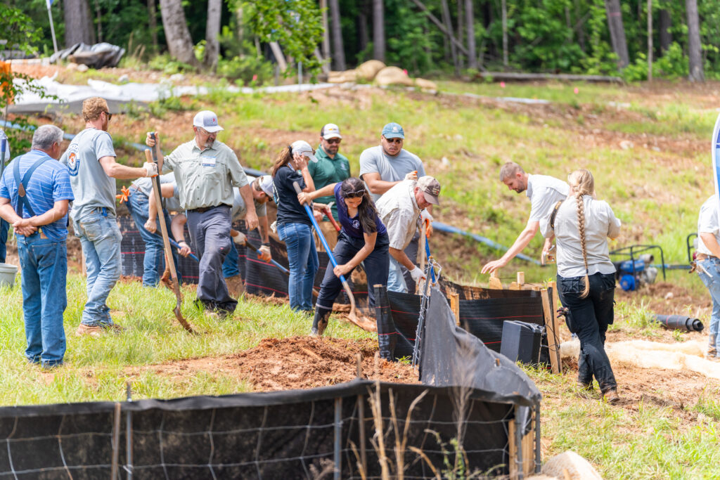
Over time, this commitment to environmental protection has fueled a manufacturing industry focused on developing products that meet performance expectations while offering cost savings. From silt fences to wattles to sediment logs and filter socks, erosion control solutions have evolved significantly. Yet now, a new generation of concerns is pushing the industry even further — toward materials that not only perform and save money but that align with sustainable and ecological best practices.

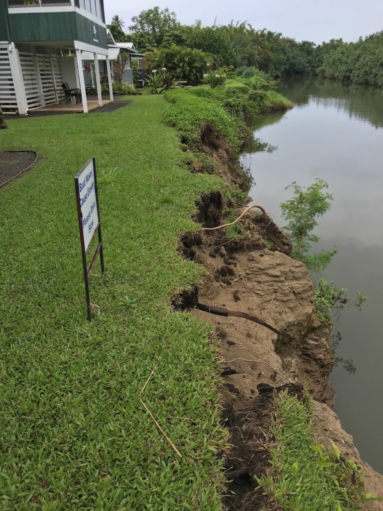
One of the most significant turning points came in 2020, when Melissa Starking of the Fish and Wildlife Service (FWS) and Carrie Tansy of the FWS Michigan Ecological Services Field Office presented findings on wildlife-friendly erosion control.2 Their research revealed some troubling consequences of common practices. Specifically, they found that synthetic netting used in many erosion control products was trapping wildlife, particularly migratory birds, reptiles and small mammals. Furthermore, they discovered that many of these geotextile products were breaking down into microplastics, ultimately contributing to waterway pollution, which was the very thing these products were supposed to prevent.

The report outlined a spectrum of practices ranging from “not wildlife-friendly” to “wildlife-friendly” and offered recommendations for minimizing harm to ecosystems. It was a wake-up call for the industry. While progress had been made in water quality protection, new evidence showed that some widely used materials might be doing harm elsewhere.

This revelation struck a chord with companies such as the author’s. They already manufactured Siltworm by using 100% recycled, biodegradable fill materials and incorporating repurposed lumber waste from construction sites. It was a low-profile, highly effective solution that had been replacing traditional silt fences in many applications.

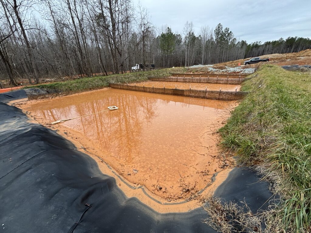
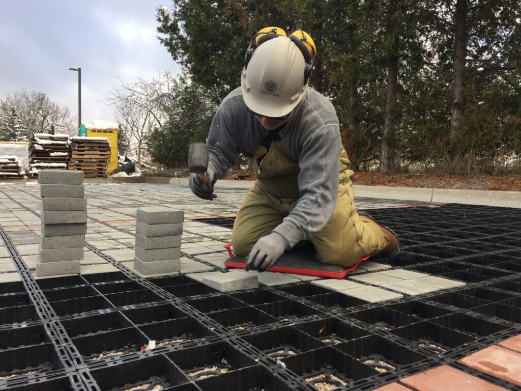
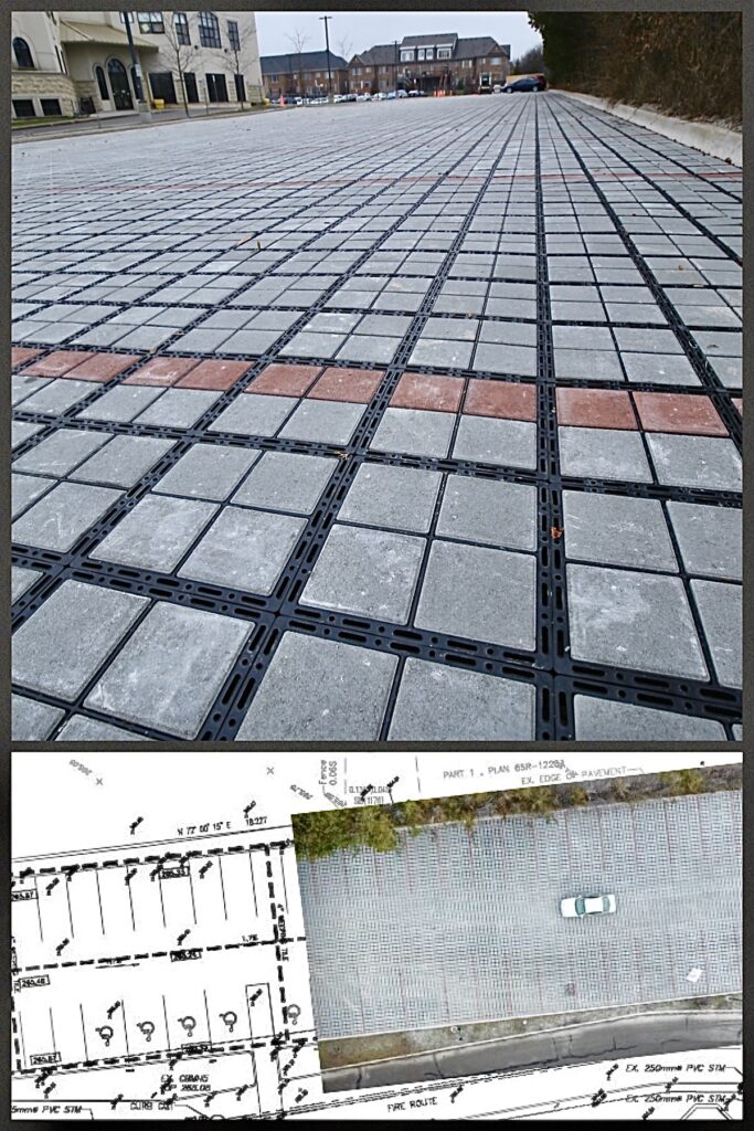
National Sales Manager Tiff Arcella at the author’s company said, “We were reducing waste, recycling on-site materials and improving sediment retention. But when we saw the USDA’s findings, we realized there was still more work to do, especially with the netting.” In two years, Bioworm kept over 30 million pounds (13.6 million kg) of wood waste from entering the landfill. Supporting calculations are four million linear feet (1.2 million linear meters) produced at a minimum of four pounds per linear foot (1.81 kg) equals 16 million average pounds annually (7.3 million kg) or 32 million pounds (14.5 million kg) of waste kept from landfills in the last two years (Figure 1).

The fill material was sustainable, but the outer netting still relied on plastic-based geotextiles that posed risks of degradation and wildlife entanglement. The mission was clear: Redesign the product to be as sustainable on the outside as it was on the inside, without sacrificing performance or blowing up costs.

Natural degradation takes place with netting material.
Figure 2. Natural degradation takes place with netting material.

That challenge was complex, according to President Mike Lorenzo at the author’s company. “There’s a fine line between a truly engineered solution and a commoditized product,” Lorenzo explained. “We needed something durable enough to survive a construction cycle, cost-effective enough for our clients and sustainable enough to avoid contributing to the microplastics problem. That’s not an easy equation to solve.”

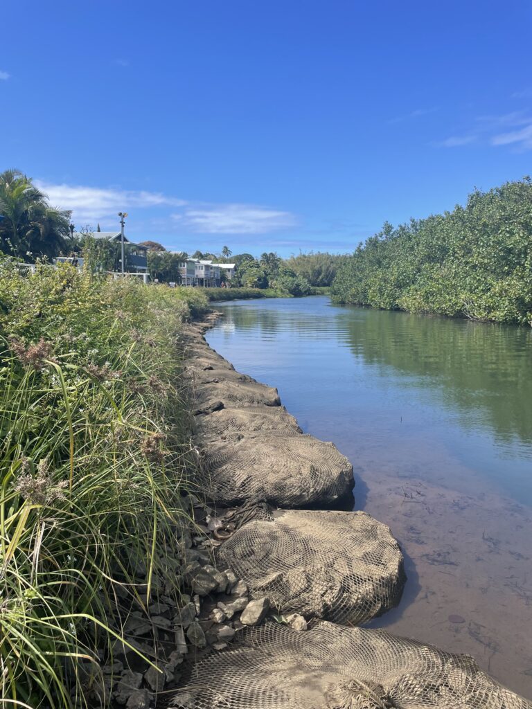
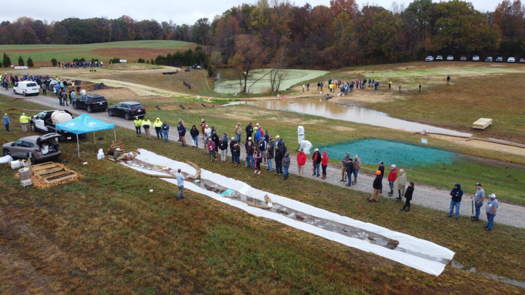
After extensive development and testing, the company introduced BioWorm, a new generation filter sock using netting made from certified fibers and textiles that are proprietary. These materials were designed to safely decompose, without releasing harmful particles into the environment. Third-party testing simulated diverse conditions, including landfills, wastewater treatment facilities, stormwater systems and natural soils, to confirm its performance and environmental safety.

BioWorm achieved a 95.7% sediment retention rate during ASTM D5141 bench-scale testing, as verified by TRI Environmental, a third-party laboratory. Large-scale ASTM D7351 testing revealed 85% soil retention and 91.9% seepage effectiveness.

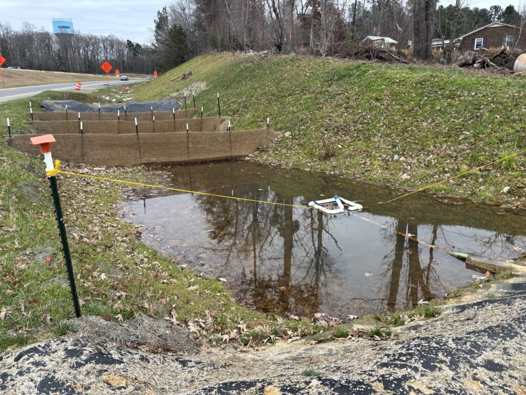
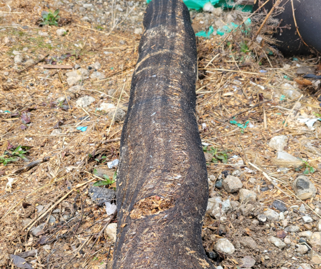
Operationally, BioWorm offers additional advantages. Because of its ability to break down (Figure 2) while drastically reducing microplastic introduction, it can often be left in place after a project concludes, which reduces the need for costly removal and disposal. “That alone can be a game-changer for constructors,” Lorenzo said. “Removal is a huge expense, and if we can eliminate that step while improving performance and protecting the environment, everybody wins.”

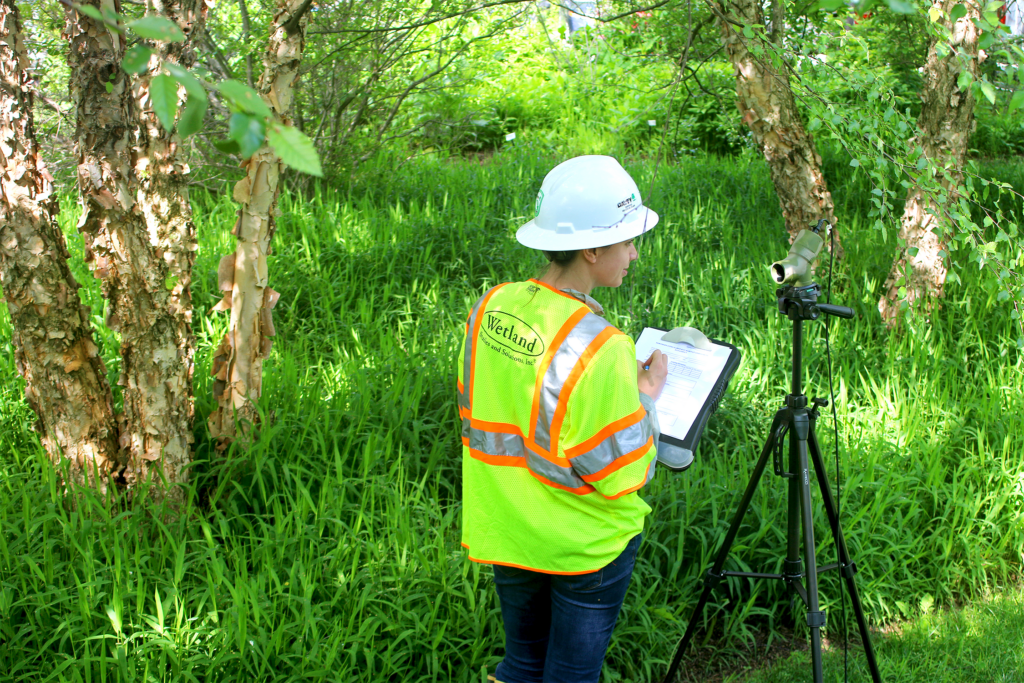
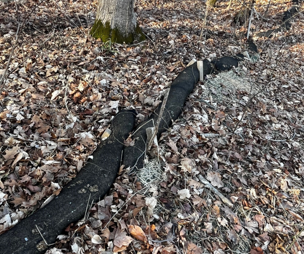
Michele Meyer, senior stormwater specialist with Resolution Group, recently applied BioWorm to a test site on the Interstate Highway 69 expansion outside of Indianapolis (Figure 3). Meyer has used BioWorm for slope stabilization, streambank stabilization and perimeter protection on large, fast-moving jobs and federal infrastructure projects. She reported instant and long-term options for trouble areas.
“Saves time and money, and there is no need to replace or remove,” Meyer said. Data from the stormwater pollution prevention plan installation and services company indicates that removal costs can often be up to 30% of the installation costs of perimeter controls.
This percentage means that if a contractor spent 10% more on the sustainable product, they would save approximately 20% on overall project line-item costs.

But innovation doesn’t stop with product development. The company is working with regulators and engineers to shift the way projects are specified. Instead of writing generic specs that lead to the lowest-cost product winning by default, they’re advocating for engineered solutions to be written into project documents — solutions that factor in long-term environmental impact, not just upfront cost.

“This is where real change happens,” said Lorenzo. “If we want better outcomes, we have to start upstream, with better design and specification. Our industry is capable of incredible innovation. We just need the right framework to support it.”

BioWorm has demonstrated what’s possible when manufacturers, engineers and regulators collaborate to meet the challenges of our time. It’s a product born from necessity, refined through science and guided by a vision of a more sustainable future.

Sustainability and affordability do not have to be mutually exclusive. In the ongoing journey to build a cleaner, more responsible world, BioWorm is helping to lead the way sustainably and cost-effectively.

A tiered or stacked installation on a construction site on the shoreline of
Lake Michigan, USA.
Figure 3. A tiered or stacked installation on a construction site on the shoreline of Lake Michigan, USA.

References

  1. Environmental Protection Agency. Learn About
    Sustainability. epa.gov/sustainability/learn-aboutsustainability.
  2. Starking M. 2021. Wildlife-Friendly Erosion Control.
    Fish and Wildlife Service. bit.ly/3GXnRP1.

Effective Design ForSediment Basin HasFour Parts

An inflow channel stabilized with geotextile liner and rip-rap.
Effective Design For Sediment Basin Has Four Parts

Sediment basins are temporary sediment and erosion control measures designed to capture stormwater runoff on construction sites before off-site discharge. The primary function of these basins is to provide storage volume and time to promote the gravitational settling of soil particles suspended in stormwater runoff. Once these particles fall out of suspension and accumulate on the bottom of the basin, the remaining clarified water can be safely discharged off-site.

These enhancements aim to extend the lifespan of construction exit pads and improve their efficiency, particularly in high-traffic construction sites.

A well-designed sediment basin consists of four main parts: an inflow channel, a settling pond with porous baffles, a dewatering device and an auxiliary spillway.

Part One: Inflow Channel

The inflow channel is a channel that collects stormwater and conveys water in a controlled fashion to the inlet of the basin. Temporary or permanent stabilization is important throughout the length of the inflow channel to prevent erosion. Protecting the channel with vegetation, geotextile liners or riprap in place will prevent the channel itself from becoming a source of sediment (Figure 1).

Installing ditch checks along the inflow channel allows for initial dissipation and collection of sediment. Capturing rapidly settling soil particles before they enter the basin provides more room in the basin for the finer sediment particles to settle. This initial treatment facilitates access for maintenance, which allows sediment to be removed more frequently without the use of heavy machinery.

Part Two: Basin (Settling Pond)

The preferred shape of a sediment basin is rectangular; however, depending on site conditions and topographic restraints, different shapes may be employed. Designing a basin with a length-to-width ratio of 2:1 or greater will create a longer flow path from the inflow to the outflow of the basin, which gives more time for settling to occur before off-site discharge. As with the inflow channel, stabilization of the inlet and the side slopes will prevent increasing turbidity levels from erosion occurring in the basin.

The volume of the basin is split into different zones. At the bottom of the basin is a standing pool, a permanent volume of water designed not to dewater but only to infiltrate or evaporate. This pool serves to detain the water with the highest concentration of sediment for an extended period, which allows for additional sedimentation to occur. This process also serves to slow water as it enters the basin, which reduces turbulence and the risk of resuspension of already-accumulated sediment in the basin.

Above the standing pool is the stormwater storage, which is the volume of the basin designed to be dewatered by the primary dewatering device. This volume should be 3600 feet3 (102 m3) per acre of the total drainage area of the site or designed to handle a two-year 24-hour storm, and it extends from the elevation of the primary outlet to the bottom of auxiliary spillway.

At the top of the basin is additional storage designed to discharge over the auxiliary spillway when flow rates and/or flow volume are beyond the capacity of the primary dewatering device. This storage should be designed to handle a 10-year 24-hour storm peak flow rate.

Lastly, designing some freeboard above the auxiliary spillway volume allows for water to be contained within the basin and not overflow during heavy storms.

A series of three porous baffles configured perpendicularly to flow from the inlet to the outlet.
Figure 2. A series of three porous baffles configured perpendicularly to flow from the inlet to the outlet.

Promote Sedimentation: Porous Baffle

Typical flow in a basin without baffles would see high-speed runoff enter the basin and move at a high velocity down the middle of the basin toward the outlet, which increases overall turbulence while ignoring using the sides of the basin for sediment settling. Porous baffles serve to improve the efficiency of sediment basins by spreading flow across the entire width of the sediment basin and slowing flow velocity to facilitate gravitational settling.

Initial flow into the basin will generally be turbulent, and when there is turbulence, there inhibits the ability of sediment to settle to the bottom of the basin easily. Water that makes its way through a porous baffle will see its turbulent flow converted to laminar flow, and with laminar flow comes smooth sheets of water flowing on top of each other with little to no turbulence, creating conditions ideal for settling to occur.

A minimum of three porous baffles should be installed perpendicularly to the flow of water between the inlet and the outlet to ensure the entire surface area of the basin is used for settling (Figure 2). One effective material for baffles is coir fiber matting sized between 700 to 900g/m2 (21 to 27 oz/yard3). Baffles should be installed so they are fully extended into the side slopes and the bottom of the basin and at a height that matches the depth of the flow over the auxiliary spillway. Flow should not be allowed under, over or around the baffles.

Part Three: Primary Dewatering Outlet

In a basin, as water settles to the bottom of the pond, the water at the surface will always have the lowest concentration of sediment. Therefore, basins must be dewatered from the top of the water column. The preferred method to accomplish dewatering from the surface is with a surface skimmer.

Skimmers float on the surface of the water. They rely on gravity to remove water from the surface and make it flow through their plumbing and eventually through the outlet of the basin. The skimmer rises and falls as the basin fills and drains. The size of the orifice of the skimmer controls the rate at which the basin is dewatered. The design dewatering time of a basin is two to six days. Dividing the stormwater storage of the basin by this dewatering time will determine the necessary flow rate for the skimmer. It is important to list the manufacturer of the skimmer used as the basis for design on project plans. This ensures that the skimmer with the appropriate flow rate is installed in the basin.

Skimmers should be installed near the outlet of the basin to allow for maximum flow time for water from inflow to outflow (Figure 3). Giving the skimmer something to rest on, like a bed of riprap or a dewatering pad, will keep the skimmer from getting mired in sediment when it is at the bottom of the basin.

Part Four: Auxiliary Spillway

Auxiliary spillways are put in place to allow excess water to safely bypass the basin when full, and they should be installed in every sediment basin. As with skimmers, these should be installed as far as possible from the inlet to maximize flow length. The spillway should be designed for a 10-year 24-hour storm peak flow rate. Also, as with other parts of the basin, it should be stabilized with nonerosive liner, vegetative cover, or stone to minimize erosion.

A skimmer resting in a standing pool near the outlet of the basin.
Figure 3. A skimmer resting in a standing pool near the outlet of the basin.

About the Expert
Matthew Love is the inside sales manager at Faircloth Skimmer. He has certifications for stormwater control measure inspection and maintenance and level I erosion and sediment control in North Carolina.

Updates from IECA Standards and Practices Committee: Current Projects, Future Goals

Sediment basin with porous baffles and a skimmer on a roadway construction project.
Cover. Sediment basin with porous baffles and a skimmer on a roadway construction project.

The International Erosion Control Association (IECA) Standards and Practices Committee has been creating new standards for the erosion control industry. The Committee works to develop, refine and disseminate best management practices (BMPs) for mitigating environmental impacts from construction. These standards serve as a foundation for professionals tasked with balancing the demands of infrastructure development with the duty to comply with environmental regulations. The Committee uses modeling and research to guide the way erosion control is approached to ensure standards follow BMPs. The standards are comprehensive and address everything from technical specifications to inspection and maintenance, and they aim to empower stakeholders across the industry to adopt solutions that are practical and sustainable. This commitment has made the Committee a resource in the field of erosion and sediment control. For more information
about the Committee, go to ieca.org/sp.

Progress and Development

  1. Erosion and Sediment Control Terminology Standardization
    To streamline communication across the industry, the Committee has developed a comprehensive glossary of erosion and sediment-control terminology. Key terms include:
  • BMPs – Defined as a collection of measures to effectively mitigate erosion and manage sedimentation.
  • Forebay – Described as an impoundment intended to slow down water and facilitate sedimentation when placed upstream of detention based practices.
  • Hydraulic Growth Medium – Clarified by hydraulically applied media that promote vegetation when topsoil is absent or deficient.

It is a useful resource, especially for those newer to the erosion and sediment control industry, to look up terms that are not familiar. This glossary standardizes language, which promotes consistency and understanding among professionals.

2. Temporary Sediment Basin Standard
Temporary sediment basins are essential for capturing sediment-laden runoff on construction sites before water discharge. The new standard introduces:

  • Optimal Design – Updated specifications on basin size, geometry and detention times to maximize sediment-capture efficiency. Best practices include incorporating multiple porous baffles to dissipate energy and enhance sedimentation (Cover photo).
  • Innovative Dewatering Techniques – The inclusion of surface skimmers ensures sediment remains undisturbed while water is discharged. This improves the efficiency of sediment basins.
  • Maintenance Guidance – Regular inspection and sediment removal protocols prolong basin lifespans.

A design guide is included with the standard to demonstrate how to size the temporary sediment basin based on runoff quantity from the design storm. This detailed guide gives practitioners the tools they need to design temporary sediment basins.

Construction Exit Pad.
Figure 1. Construction Exit Pad.

3. Construction Exit Pad Standard
Construction exit pads are designed to minimize soil track-out and debris from construction vehicles (Figure 1). Recent updates to the standard emphasize material specifications and improved design to accommodate varying site conditions. For example:

  • Length and Width – The Committee highlighted the need for customization based on site-specific vehicle traffic and soil conditions. Exit pads should be designed to accommodate narrow and wide access points, which ensures flexibility for different projects.
  • Geotextile Underlays – To improve durability, the standards recommend integration of nonwoven geotextile underlays beneath aggregate pads.
  • Traffic Control Features – Updated guidance includes measures such as flaring exit pad ends and the incorporation of a turning radius for safe vehicle movement while minimizing soil disturbance.

These enhancements aim to extend the lifespan of construction exit pads and improve their efficiency, particularly in high-traffic construction sites.

4. Sediment Filter Bag Standard
Sediment filter bags are a critical component of dewatering systems, as they filter stormwater runoff and capture coarse particles. Recent advancements focus on:

  • Material Resilience – Nonwoven geotextiles are now standard due to their improved filter capacity and durability. The Committee also recommends materials resistant to ultraviolet (UV) rays to withstand prolonged exposure.
  • Strategic Placement – Emphasizing level ground installation promotes good functionality and minimizes risks of water bypass. Also, anchoring methods like stakes or sandbags enhance stability.
  • Inspection Protocols – Guidelines recommend frequent inspection and timely replacement of sediment filter bags to prevent clogging and maintain efficacy.

These updates improve the reliability of sediment filter bags across various site conditions.

Ongoing Initiatives
As the Committee continues its mission, the focus has expanded to developing standards for floating turbidity curtains and hydromulch applications. These standards are expected to be completed in 2025.

  1. Floating Turbidity Curtain Standard
    Floating turbidity curtains are used for controlling sediment in aquatic environments. These curtains are designed to isolate sediment-laden water, which allows particles to settle in an enclosed area. The Committee’s upcoming standard will address key aspects:
  • Design and Materials – Curtains are crafted from durable geotextile fabrics reinforced with ballast chains and flotation units. The standard will emphasize materials capable of withstanding UV exposure and hydraulic forces.
  • Effective Placement – Guidelines will consider different configurations, such as U shape, to isolate areas without obstructing the full channel width and account for flow velocity and tidal variations.

2. Hydromulch Standard
Hydromulching, a practice involving the application of a slurry of water, mulch and seed, is a key method for stabilizing soil and promoting vegetation growth. Planned standards will provide:

  • Composition Recommendations – Guidance on selecting appropriate mulch types and additives based on climate and soil conditions.
  • Application Techniques – Best practices for even distribution and adherence to soil.
  • Rates – Adjusting rates based on the site-specific conditions such as percent slope, slope length, soil type, aspect and expected longevity.

Closing Thoughts
The Committee remains dedicated to advancing erosion and sediment control measures. The Committee is working to
ensure professionals have access to design standards made with current BMPs. The Committee’s efforts are making a lasting difference in the industry by developing design standards that can be used in a multitude of environments. As the Committee continues to develop and refine its standards, the Committee members hope more professionals will incorporate IECA design standards into their projects. For more information about the Committee, check out the website at ieca.org/sp. There, you’ll find all the standards and the glossary (Figure 2).

IECA Standards and Practices Committee Standards and Glossary.
Figure 2. IECA Standards and Practices Committee Standards and Glossary.

About the Expert
Christina N. Kranz, Ph.D., is a Lecturer and Research Associate at North Carolina State University.

Wetlands to Remediate Agricultural Drainage: Reducing Nutrient Discharges to Minimize Impacts to Waterways

Fish production in aquaculture tanks.
Figure 1. Fish production in aquaculture tanks.

Agricultural production often results in discharges of water heavily laden with nutrients, which results in negative impacts on receiving waters including algal blooms and eutrophication. Several types of constructed wetlands were tested recently to determine their potential for treating these waters to remove nutrients before discharge.

Modeling Constructed Wetlands

Researchers in one study tested different substrates in model constructed wetlands to determine which would best remove nitrogen (N), phosphorus (P) and chemical oxygen demand (COD) from simulated farm runoff.1 The model systems were contained in 16 cm diameter by 45 cm tall (6.3 x 17.7 inch) plastic pipes. The control treatment had 20 cm (7.9 inches) of 3 to 5 mm (0.12 to 0.2 inch) gravel, while two other treatments included 10 cm (3.9 inch) gravel plus 10 cm (3.9 inch) iron-carbon composites (FeC) or 10 cm (3.9 inch) iron-carbon composites mixed with ground walnut shells (WFeC). In addition, another treatment was the same as WFeC but included inoculation with a denitrifying phosphate-accumulating bacteria (MWFeC). All of the columns were inoculated with activated sewage sludge, planted with four Iris tectorum plants, and allowed to equilibrate for a month before dosing. There were three dosing periods of 40 days each, with simulated runoff being added daily to the top while removing an equivalent volume from the bottom. The pollutant concentrations during the first period were 6.0 mg NO3 -N L-1, 3.0 mg NH4+-N L-1, 0.4 mg total phosphorus L-1 (TP) and 15.0 mg COD L-1 in the form of sucrose and fulvic acids. In the second phase, the concentrations were doubled, and in the third phase, the concentrations were doubled again. The removal of NO3 increased substantially (>2X) in all treatments relative to the gravel control, with the WFeC and MWFeC treatments achieving up to 88% and 94% removal, respectively. Increasing the NO3 concentration decreased removal rates, but the MWFeC treatment still removed 77%. Removal of NH4 hovered around 60%–70% regardless of the substrate or the concentration. Total N removal followed the NO3 pattern for the treatment effects and peaked at around 75% for the MWFeC treatment at the highest concentration. Removal of TP was in the 30%–40% range for the gravel alone and about twice that for the other substrates. Similar to the nutrients evaluated, COD removal was increased with the FeC substrate and was the greatest in the MWFeC treatment at up to 90%. Iron concentrations remained low (<0.2 mg L-1) in the effluent. The authors also measured several greenhouse gases (CO2, CH4, N2O) to determine the potential for the different substrates to negatively impact global warming initiatives. The results were much more mixed than those of the column water. At the lower nutrient concentrations, generally fewer greenhouse gas emissions came from the FeC columns compared to the gravel alone. However, at the highest nutrient concentration, emissions were about 2X when the FeC material was used in the columns.

Removing Nutrients with Cattail

In a second study, aquaculture waste water (WW) was collected from a trout production facility and added to 2.5 m (8.2 feet) diameter stock tanks consisting of 15 cattail plants planted into 20 cm (7.9 inch) topsoil and flooded to a 30 cm (11.8 inch) depth.2 The system was allowed to establish itself for 40 days before adding the WW. Then the WW was added weekly at five doses over five weeks. The total N and P loading over the entire period was 14, 35, 77, 131 and 209, and 3.0, 7.6, 17, 29 and 46 mg m2 (10.7 feet2) respectively. Weekly grab samples were obtained 1 to 2 days before dosing and analyzed for TP, total dissolved phosphorus (TDP), soluble reactive phosphorus (SRP), total dissolved nitrogen (TDN), total ammonia N (TAN), nitrite N (NO2-N), and nitrate N (NO3-N). Cattail height was measured weekly, and plant samples were taken after approximately three and seven weeks after the first WW dosing. There were tanks with cattails that received no WW and served as the controls. There was no pattern of response in the growth of the cattails related to the dosing, possibly because the cattail plants had undergone rapid growth in the period before dosing was initiated. The authors suggested there may have been a measurable response in the tubers, but these were not sampled. The system appears to readily absorb the added N, although some NO3-N spikes were detected, possibly coming from the soil. The P added to the cattail systems resulted in higher P in the water column initially, directly related to dose, but even at the highest dosing, the total P in the water column was <0.05 mg L1 at the end of the dosing. The 96% reduction in P concentrations occurred in spite of the relative lack of growth of the cattail plants during the dosing period. The authors suggest that this finding indicates that this type of constructed wetland can remediate WW even after the main growth period for the plants. (An example of fish production in aquaculture tanks is shown in Figure 1.)

Wetlands to Remediate Agricultural Drainage
Figure 1. Fish production in aquaculture tanks.

References:

1. Cun D, Wang H, Jiang M, et. al. 2024. Effective Remediation of Agricultural Drainage at Three Influent Strengths by Bioaugmented Constructed Wetlands Filled with Mixture of Iron Carbon and Organic Solid Substrates: Performance and Mechanisms. Science of the Total Environment 947. doi.org/10.1016/j.scitotenv.2024.174615.
2. Blandford NC, McCorquodale-Bauer K, Grosshans R, et. al. 2024. Removal of Nutrients from Aquaculture Wastewater Using Cattail (Typha Spp.) Constructed Wetlands. J Environ Qual. 2024; 53:767-775. Doi: 10.1002/jeq2.20608.

About the Expert
Rich McLaughlin, Ph.D., received a B.S. in natural resource management at Virginia Tech and studied soils and soil chemistry at Purdue University for his master’s degree and doctoral degree. He has retired after 30 years as a professor and extension specialist in the Crop and Soil Sciences Department at North Carolina State University, specializing in erosion, sediment and turbidity control. He remains involved with the Department as professor emeritus.

Harnessing AI-Powered Tools For Compliance — Part 2

Figure 1. In a world of Agentic AI, an AI model could launch UAVs to collect data, analyze the data through deep learning image recognition, determine a corrective action and act on that action. This image was generated by Copilot.

While still a relatively new technology, custom generative artificial intelligence (AI) is now being explored for developing stormwater and other compliance documents, or at least acting as an assistive tool. Consider an AI model trained in all current state-specific construction general permits and consider what prompts, or questions, might be asked to generate the necessary documents. Now, let’s take a deeper dive into this application and examine its future potential within the industry.

Although the end user would need to confirm that the source data is up to date and hasn’t been superseded by a new general permit, the AI could respond to questions like “What are the stabilization requirements in Texas?” by extracting all relevant references to stabilization directly from the permit. Professionals who have developed a Storm Water Pollution Prevention Plan (SWPPP) for a state with a non-searchable general permit, such as a photocopy on a state website, are familiar with the struggle of repeatedly scanning the permit to avoid missing any crucial detail or exception. This is merely one example of how custom generative AI models can be utilized. Alternatively, they could be trained on various Code of Federal Regulations, state administrative codes, local ordinances and more.

Looking to the future, new AI-powered applications have the potential to enhance SWPPPs and other compliance plan preparation. For instance, machine learning algorithms can analyze historical data to identify patterns and trends to facilitate predictive modeling for potential risks and optimization of BMP selection and mitigation measures, such as BMP maintenance. AI-based programs could potentially prepare SWPPPs and other compliance plans, while natural language processing algorithms could enable efficient data extraction from documents and assist in automating compliance reporting tasks and permit filing. These advancements have the potential to contribute to reducing preparation time while improving overall plan efficiency.

An intriguing prospect arises with the development of agentic AI (Figure 1). Agentic AI consists of AI agents that are designed to act independently of human intervention, unlike traditional AI that depends on user inputs, to understand their environment, set goals and act to achieve those goals.1 Imagine the possibility of an AI agent trained to launch scheduled drone flights to collect data, analyze patterns in that data, generate predictive modeling and initiate preventive actions such as robotic machines to repair silt fence, mow vegetation, etc. While this may sound like something from a futuristic sci-fi movie, leading companies such as Tesla and Nvidia, along with smaller startups, are actively working to turn these ideas into reality.

Figure 2: Substations are an integral part of data center infrastructure required to support AI.

Navigating the Risks
While AI is advancing rapidly, its widespread adoption still faces significant challenges. One of the primary concerns is the current state of the technology itself. Despite notable progress, AI systems remain imperfect, as users can attest. Many AI applications, such as autonomous systems, still struggle with unpredictable real-world scenarios like self-driving cars, which perform well in controlled conditions but fail to handle complex, unforeseen events. Factors that can contribute to the challenges of the current state of AI technology include limited data sets or erroneous/outdated source data, trainer bias in the model and user error.

As the excitement and enthusiasm of the initial onset of generative AI begin to fade, there is a shift as the reality of AI use sets in. Companies are struggling to answer the question of how AI can be integrated into their existing systems and workflows, and that includes those in the environmental compliance industry. Users are quickly learning that having vague concepts of an idea for use makes it difficult to build out generative AI models. An example of a vague concept would be “Let’s build an AI that generates SWPPPs.” It is important to have a very detailed, clearly defined use case.1

The adaptation and integration of AI-powered tools in compliance documentation compliance also introduces inherent risks in the form of significant legal and ethical concerns. AI models must be designed to navigate a complex web of legal considerations, ranging from data privacy laws and confidentiality agreements to intellectual property rights and liability issues regarding compliance with industry-specific regulations. Moreover, the user must also be aware of this necessity.

Additionally, there are growing concerns about transparency and accountability in AI decision-making processes. As AI models become more complex, the “black box” nature of some systems makes it difficult to audit or fully understand how decisions are being made, which poses a risk regarding regulatory compliance and ethical governance. Because AI systems are trained on historical data, they can inadvertently learn and perpetuate existing biases present in that data. AI systems often rely on vast datasets to function effectively, and some of this data comes from published intellectual property collected through digital platforms. Use of this data raises questions about consent, ownership and how that data is stored, shared and analyzed.2

These risks highlight the importance for regulation in the industry that calls for appropriately vetting the data and algorithms on which the AI is trained and transparency by developers. Ethical frameworks and guidelines such as data anonymization and bias reduction techniques will be essential to foster trust.2 These risks are becoming highly recognized as evidenced by the world’s first comprehensive AI law, the European Union’s AI Act, which took effect August 2024.

Another potential future challenge in the development and advancement of AI lies in the continuing efforts for greener infrastructure for the data centers that AI compute relies on, particularly when considering the massive infrastructure required to support it. According to the United States Office of Energy Efficiency and Renewable Energy, these facilities are among the “most energy-intensive building types.”3 (Figure 2) These facilities also use a considerable amount of water in cooling systems. According to NPR, their “reliance on water poses a growing risk to data centers.”4 This usage consumption scale raises critical concerns about the environmental impact of AI development and the related strain on local infrastructure. Balancing the growth of AI capabilities with environmental responsibility is becoming an urgent consideration as the industry moves forward at an ever-accelerating pace.

The future of AI holds immense potential for innovation and efficiency in development of stormwater and environmental compliance documentation. As custom-built models and advanced systems become more prevalent, it is crucial for organizations to address the associated risks and ethical considerations proactively. Ensuring the continuous improvement of data quality, promoting transparency in AI decision-making and adhering to strong legal and regulatory frameworks will be key to navigating this rapidly evolving field. By aligning the transformational potential of AI with socially responsible and ethical practices, organizations can effectively leverage these technological advancements to enhance efficiency and quality in stormwater and environmental compliance document development.

Editor’s Note: The first part of this series appeared in the First Quarter 2025 issue of Environmental Connection and reviewed
the emergence of the AI revolution, today’s capabilities and current applications.

References

  1. Craig, L. (2024) 10 top AI and Machine Learning Trends for 2024: TechTarget, Enterprise AI. Available at: https://www.techtarget.com/searchenterpriseai/tip/9-top-AI-and-machine-learning-trends (Accessed: February 2024).
    Patel, K. (2024) ‘Ethical Reflections on Data-Centric AI: Balancing Benefits and Risks’, International Journal of Artificial Intelligence Research and Development (IJAIRD), 2(1), pp. 1–17.
  2. Data Centers and Servers (no date) energy.gov. Available at: https://www.energy.gov/eere/buildings/data-centers-and-servers (Accessed: 2024).
  3. Copley, M. (2022) Data Centers, backbone of the digital economy, face water scarcity and climate risk, NPR. Available at: https://www.npr.org/2022/08/30/11199
    38708/data-centers-backbone-of-the-digital-economy-face-water-scarcity-and-climate-ris (Accessed: 2024).

About the Experts

  • John England is a lead environmental scientist for Black & Veatch’s Construction Stormwater and Environmental Compliance practice. He provides environmental support and input during proposal and project development, including implementing and managing overall environmental compliance efforts during construction.
  • Kayla Cottingham leads the Construction Stormwater and Environmental Compliance practice at Black & Veatch. She leads the team’s environmental support and input during proposal and project development, including implementing and managing overall environmental compliance efforts during construction.

Protected Bats: Compliance and Conservation

Figure 1. Range maps for Indiana Bat, Gray Bat, Northern Long-Eared Bat and Tricolored Bat. (Data from FWS.)

The continental United States hosts a diverse array of bat species vital to our ecosystems. However, several bat species are facing significant threats, including disease, habitat loss and human disturbance. Special attention has been given to cave-dwelling species impacted by white-nose syndrome, a deadly fungal disease. This article explains the protections in place for federally listed bats in the United States, with a focus on how project proponents can ensure compliance with the Endangered Species Act (ESA).


Listing Status
The ESA was enacted in 1973 in the United States to establish protection for species that are at risk of extinction, which are listed under the ESA as threatened or endangered. Under Section 7 of the ESA, projects that require a federal action are required to coordinate with the United States Fish & Wildlife Service (FWS) regarding the potential for a “take” (harass, harm, pursue, hunt, shoot, wound, kill, trap, capture or collect, or attempt to engage in any such conduct)1 of species within the project area. Projects that require a federal action are authorized, permitted, licensed, funded or being carried out by a federal agency in whole or in part.
Projects that do not require a federal action may still need to coordinate with FWS under Section 10 of the ESA to determine if an action is allowed or if an incidental take permit will be required. Note that coordination is not required under Section 10, but the responsibility is on project proponents to ensure compliance. Any violations of the ESA are punishable by law and can result in civil and criminal penalties.
While this article focuses on federal regulations, many states have additional protections in place for bats. Consulting with state agencies is essential to ensure compliance with all laws.


Several bat species are listed or proposed to be listed under the ESA. Four species cover a large area of the continental United States, and their associated conservation measures have significant implications for development processes, as well as the maintenance of transportation and utility infrastructure. The Indiana bat (IBat), northern long-eared bat (NLEB) and gray bat (GBat) are listed as endangered. On September 13, 2022, the FWS announced a proposal to list the tricolored bat (TCB) as endangered, but the current timing for the final listing is unknown.


For any federally listed species whose range mapping intersects with a project’s action area (Figure 1), projects must determine if a site contains suitable habitat for any species on their species list. This will enable project proponents to understand if their project activities are likely to adversely affect the listed species. If regulatory agencies agree that a project site does not have a suitable habitat and activities will not affect the species, conservation measures will not be needed.


Suitable Habitat
In general, the presence of trees or manmade structures (including bridges and culverts) will indicate potentially suitable summer habitat for bats. Suitable summer habitat is described further in this article for each species, as there are slight differences.
Suitable winter habitat is also important to identify in a project area. Sites with karst geology (e.g., caves and sinkholes) may provide suitable winter habitat. If a project falls within any hibernacula buffers such as caves or mines where bats will hibernate over the winter, as mapped by the FWS or a state agency, more restrictions may be imposed.

Figure 2. Scientist with Wetlands Studies and Solutions, Inc., setting up an acoustic detector for a presence/absence bat survey.


Indiana Bat (Myotis Sodalis)
Suitable summer habitat for IBat includes forests and woodlots containing potential roosts (i.e., live trees and/or snags less than or equal to 5 inches [12.7 cm] at diameter breast height [dbh] that have exfoliating bark, cracks, crevices and/or hollows), as well as linear features such as fencerows, riparian forests and other wooded corridors.
IBats also roost in human-made structures, such as bridges and bat houses (artificial roost structures); therefore, these structures should also be considered potential summer habitats.


Northern Long-Eared Bat (Myotis septentrionali)
Suitable summer habitat for the NLEB includes forests and woodlots containing potential roosts (i.e., live trees and/or snags less than or equal to 3 inches [7.6 cm] dbh that have exfoliating bark, cracks, crevices and/or cavities), as well as linear features such as fencerows, riparian forests and other wooded corridors.


The NLEB also roosts (although to a lesser degree than forested habitat) in human-made structures such as buildings, barns, bridges and bat houses. These structures should also be considered potential summer habitat.
Gray Bat (Myotis grisescens)


GBats occupy caves or cave-like structures year-round. While gray bats prefer caves, summer colonies have been documented using dams, mines, quarries, concrete box culverts and the undersides of bridges. Most gray bats roost in as few as 15 major hibernacula; therefore, any impact to any one of the hibernacula could result in the loss of a significant amount of roosting habitat or bats. Of these four bat species, this species is the only one that does not use forested areas/trees for roosting.


Tricolored Bat (Perimyotis Subflavus)
Suitable TCB summer habitat includes forests, woodlots and linear features (e.g., fencerows and riparian corridors) containing trees with potential roost substrate (e.g., live and dead leaf clusters of live and recently dead deciduous trees, Spanish moss [Tillandsia usneoides] and beard lichen [Usnea trichodea]).


TCBs also roost in human-made structures, such as bridges and culverts, and occasionally in barns or the underside of open-sided shelters, like porches and pavilions. These structures should also be considered potential summer habitat.


Conservation Measures
Because trees provide a suitable summer habitat for federally protected bats during their breeding season, the FWS has implemented restrictions for tree-clearing activities as a conservation measure for IBat, NLEB and TCB. Time of year restrictions (TOYRs) vary depending on the region, particularly if bats are present year-round. Notably, TOYRs focus on seasons when the bat is out of hibernation and present in a suitable summer habitat or, most importantly, during the pup season. The seasons can be accessed from Appendix L: Bat Activity Table of the FWS Indiana Bat and Northern Long-Eared Bat Survey Guidelines.2


Conservation measures for winter suitable habitat include reduced activity near known hibernacula. Coordination with the local FWS Field Office (FO) is needed to determine the necessary measures for a specific project.


Surveys and Habitat Assessments
Qualified biologists can conduct surveys to assess the presence of suitable habitat and bat activity in the project area (Figure 2). Approved surveyor lists are publicly available online for each local FO. Note that the FWS Indiana Bat and Northern Long-Eared Bat Survey Guidelines outline how and when to perform presence/absence surveys (acoustic or mist-net), hibernacula assessments, emergence surveys and bridge/culvert assessments, which may be necessary to understand which conservation measures are appropriate for projects. Note that surveyors must be approved by FWS, and there are specific windows during which surveys may be conducted. All results are subject to FWS approval.


Conclusion
The FWS has established bat protection measures that require collaboration between project developers, biologists and the FWS. Coordination early in the planning process and throughout the project stages is crucial so regulators and project proponents can assess the potential for suitable habitat, agree on potential impacts and develop mitigation strategies. By understanding the legal requirements and appropriate conservation measures, project proponents can ensure their activities comply with the ESA and minimize impacts on bat populations.


The future of bat conservation depends on ongoing research, habitat protection and public education. By working together, these vital ecological contributors can be safeguarded for generations to come. 


References

  1. United States. (1983). The Endangered Species Act as amended by Public Law 97-304 (the Endangered Species Act amendments of 1982). Section 3(19). Washington: U.S. G.P.O. fws.gov/laws/endangered-species-act/section-3.
  2. U.S. Fish and Wildlife Service. 2024. Range-wide Indiana Bat and Northern Long-eared Bat Survey Guidelines. U.S. Fish and Wildlife Service, Region 3, Bloomington, MN. fws.gov/media/range-wide-indiana-bat-and-northern-long-eared-bat-survey-guidelines.

About the Experts

  • Ellyse Marques, WPIT, project regulatory specialist, Wetland Studies and Solutions, Inc., a Davey Company, is on the Virginia Field Office’s Approved Surveyor List for acoustic surveys. She coordinates projects with federal, state and local regulatory staff to ensure compliance with endangered species, wetland and other protections.
  • Alison Robinson, PWS, PWD, VSWD, CT, senior associate environmental scientist, Wetland Studies and Solutions, Inc., a Davey Company, coordinates bat habitat evaluations and acoustic surveys across the Mid-Atlantic. Her expertise also includes wetland delineation, mitigation banking monitoring and natural resource inventories.

High Tides, Hau Bush and Habitat: Hanalei Riverbank Restoration

Cover. A view of the project site and surrounding riverbank before bank improvements shows the extent of the hau bush plantings on the adjacent bank.

The Hanalei River is an active recreation river that spans nearly 16 miles (26 km) through the island of Kauai, Hawaii, United States. The river’s base begins along Mount Waialeale, where it is engulfed by 450 inches (11.4 m) of rain annually. It eventually drains its 23-mile2 (59.5-km2) watershed into the Pacific Ocean at Hanalei Bay. With daily rains, mountain runoff and tropical storms, the banks of the Hanalei River face erosion.

In 2016, design and permitting began for a 450-foot (137-m) section of riverbank restoration at a resort and retail site in Hanalei, Kauai. While typical water velocity didn’t present a huge challenge, boat traffic, frequent storms and hau bush (Hibiscus tileaceus) plantings on the opposite bank had made a huge impact on the bank stability. Due to its lightweight wood and stringy composition, hau bush was planted by early settlers for use in rope and canoe construction. Because of its cultural significance and continued use, hau bush is still grown.
The erratic branching pattern of the hau bush makes it very difficult to remove. When unmaintained, the bushes can become invasive. In the 1970s, there was a single strip of hau bush along the western edge of the riverbank. By 2017, the bushes had spread to nearly 13.5 acres (5.5 ha) of land. The bushes engulfed a nearly 200-foot-wide (61-m) buffer along the riverbank and floodplain (Cover photo). As the bushes reached the original riverbank, the exposed roots collected debris and sediment, which allowed more hau bush to expand into the shallow banks. This expansion ultimately changed the course of the channel centerline, limited the bankfull stage of the river and added a large amount of pressure against the opposite bank on the project site. Since the original construction of the cottages and retail site 40-plus years ago, nearly 20 feet (6 m) of the bank, including an access road, has eroded.

Because of the Hanalei River’s Heritage River designation, a more natural or bioengineered approach was preferred over stone or a sea wall along the banks. After considering different options and project needs, the initial design included gabion baskets as toe protection and incorporated a vegetated geobag system of nonwoven geotextile to strengthen and encapsulate
the bank.

As the project team finalized the design and neared the issuing of Army Corps of Engineers, state and local permits in 2018, a tropical storm dumped 49 inches (1.25 m) of rain in less than 24 hours. This rainfall caused extensive damage along the north shore and eroded the bank to less than 3 feet (1 m) from the footings of the infrastructure (Figure 1). With the loss of additional infrastructure and flooding of buildings, the project was put on hold. The riverbank continued to erode, and the hau bush expanded its hold into the river.

In 2022, the cottages and retail site were purchased and rebranded as the Hanalei River Cottages. The design team resumed work and began to revisit site conditions and the client’s goals. The owner wanted to continue to focus on a natural aesthetic that would withstand the harsh island elements. While the general design intent stayed the same, alternative solutions to toe protection were explored.
While gabion baskets have their place in slope protection, proper installation requires base prep and excavation that can be disruptive to the river channel and its ecology. The owners and the design team also wanted to avoid using gabions, as the epoxy/PVC coatings sometimes used to protect the metal cages can degrade quickly and cause pollution and habitat issues. After research and working with a local supplier, the design team proposed using Kyowa’s Filter Units as the toe protection. These “rock bags” could be filled with local stone and feature a rope/mesh system that would easily conform to the riverbed’s natural contours. In addition to these units’ strength and stability, the rope/mesh naturally collects algae and other organics. These organics attract fish and other organisms, which enhance the habitat along the river’s edge. Bags could be stacked from the riverbed up to sea level (Figure 2).

The first course of the system was installed with a geogrid wrap, just behind the top rock bag. There were 14–16 courses of geobags. This feature helps ensure that the geobag system is locked into the existing bank and will stay in place if the toe protection becomes compromised during a large storm.

By installing the geobags above sea level, a fully engineered, permanent encapsulated layer will provide stability and protection for the bank. The sand/topsoil mix used in the bag fill provides additional strength and a viable bed for plant growth, which creates a fully engineered vegetative solution.

Vegetation in any tidal zone is challenging. By working with local experts, a mix of native sedges and groundcovers were selected that would thrive in the harsh, salty conditions from wet to dry. Plant plugs from live plants were installed between the layers of geobags near the project completion.

Project work began in July 2023 and was completed in September 2023. By February 2024, the geobag system was fully vegetated, and the slope project withstood a near bankfull storm event that winter. There was damage from the 2018 storm (Figure 3), but full vegetation was established after restoration in February 2024. In April 2024, 5-plus inches (12.7 cm) of rain fell in two hours, which raised the river to 1 inch (2.5 cm) above the bank. While 90% of the project withstood the river forces, a small section of the toe protection and bank were damaged. Repair work included 40–50 more rock bags being added to the toe for reinforcement, minor bank repair and the addition of stormwater mitigation systems to limit the impact of overland flow and floodwaters that overtop the bank, as this was one of the main attributes to the damaged bank.

Figure 2. Graphic section detailing the design approach.

Construction wasn’t easy. Limited access to updated site information left many unanswered questions and required a design-build approach. Working in a tidal environment with frequent daily rains created constant wet conditions and a limited window for construction. Site access was also a challenge. Much like most riverbank repair projects, the construction footprint was limited, and steep slopes required a fair amount of manual labor.

Getting materials proved difficult. Historic bridges span the many waterways that intersect the Kuhio Highway, and they have limited weight capacities and allow only one traffic lane. This situation meant creating a material staging location near one bridge where materials could be dropped off by large trucks. Smaller trucks would bring daily material loads that would work with the limited capacity of the Hanalei River Bridge. Considering the need for over 100 rock bags, 4,000 geobags, plus various fill and removal materials, deliveries were constant. Weight capacities limited the project to single deliveries of three rock bags and up to five pallets of filled geobags at one time.

Just after the construction started, local citizens, nonprofits and government agencies, including The Housing and Land Enterprise of Hawaii County (HALE o Hawaii), began exploring funding opportunities to sponsor removal, revegetation and maintenance of the 20-plus acres (8 ha) of hau bush along the river from the Hanalei Bridge to Hanalei Bay. Their diligence paid off and, with the help of state Representative Nadin Nakamura, federal and state grants were achieved to support this work. Many private donors, including owners of the Hanalei River Cottages, also helped fund the project.

Figure 3. Hau bush removal within the original riverbank and flood plain.

In October 2024, a contract was awarded to Cushnie Construction for removal of 13.5 acres (5.5 ha) of hau bush along the north bank of the river, across from the cottages. The removal has since been completed (Figure 4). The open land has been reseeded with native vegetation, and the expectation is that it will be properly maintained over time. With the bush roots no longer collecting sediment and returning the northern bank into flood plain, the river will return to its natural channel and extensive flood plain. This return will reduce the erosive pressures from reaching the southern banks along the cottages and allow the natural river ecology to return. 

About the Expert
Eric Seidl, LEED-AP, WEDG, is the technical director for Envirolok. Eric lends his expertise to developing vegetative solutions for slopes, waterways and shorelines.

Partners

  • JG Consulting
  • Ka’iwa Construction
  • Summation Partners, LLC
  • Sustainable Resources Group

Construction Stormwater Training: Developing Field Day Events

Figure 1: Some field days, like this rainy AU-SRF field day, require going with the flow.

Erosion and sediment control (E&SC) practices are critical for construction stormwater management and downstream pollution mitigation. There is much debate in our industry about what E&SCs should be considered “best” management practices (BMPs). Education and outreach are a key component of federal, state and municipal permitting. To better communicate and demonstrate best practices, hands-on training events are used to help contractors, designers and inspectors better understand BMPs. In some cases, these are field day demonstrations from stormwater contractors and product manufacturers, and others get attendees involved in installations and test demonstrations. These events provide opportunities to witness how BMPs perform in simulated or, in some “lucky” years (Figure 1), actual rain events. The events included here are associated with a stormwater-related organization, research entity or a regulatory body that had outcomes specific to that state or municipality with the intent of providing technology transfer of BMPs or emerging technologies.

Auburn University Installer Training and Field Day Events
The Auburn University Installer Training and Field Day are separate, yet connected, events held annually at the Auburn
University — Stormwater Research Facility (AU-SRF) in Opelika, Alabama, USA. Since 2014, AU has trained thousands locally, nationally and internationally. The events’ successes have been impacted by industry partners like the International Erosion Control Association (IECA), industry professionals that provide vendor and sponsor support and the Alabama Department of Transportation (ALDOT), a substantial AU-
SRF research sponsor. During these events, AU-SRF researchers demonstrate emerging techniques and industry manufacturers present the newest technologies meant to improve the performance of construction stormwater BMPs.

The Installer Training event (Figure 2) is a 1.5-day classroom/hands-on hybrid training event focusing on proper installation techniques of E&SCs. The half-day classroom session discusses what they are used for, expected performance, considerations for implementation, potential failure and maintenance considerations. The hands-on full-day portion occurs at the AU-SRF, where attendees install the E&SCs. Simulated flows and rainfall will then show attendees how these practices perform. The Field Day (Figure 3) is a one-day event that typically follows the Installer Training. Field Day is held at the AU-SRF and showcases the practices installed at Installer Training, in addition to demonstrations by vendors. Participants observe how practices should be installed through exploration of techniques and live demonstrations.

Many of the standards developed at the AU-SRF have been adopted by ALDOT and the Alabama Handbook for Erosion Control, Sediment Control and Stormwater Management on Construction Sites and Urban Areas (The Blue Book), providing a unified approach regarding ESCs in Alabama and enhancing the value of the training event. Other notable partnerships (Figure 4) include state stormwater agencies, such as the Alabama Soil and Water Conservation Committee and the Alabama Stormwater Association, and Thompson Engineering, which oversees a construction stormwater inspection certification in the state. The research at AU-SRF is also funded by other state DOTs, including Iowa and Nebraska, along with federal agencies such as the Environmental Protection Agency, Department of Agriculture (USDA) and the Federal Highway Administration. These connections provide opportunities to educate and impact stormwater professionals beyond Alabama.
Bowling Green Muddy Water Blues The city of Bowling Green, Kentucky, USA, hosted the Kentucky Muddy Water Blues (KYMWB) starting in 2019 as part of their Municipal Separate Storm Sewer System (MS4) permit program. This event, one of over 150 classes and field days the city has presented, demonstrates nonproprietary BMP installations, exhibits products and provides regulatory updates. These field days are held at a city-owned site and active construction sites, with the former preferred. The target audience was erosion prevention and sediment control (EPSC) contractors certified by the city that are required to attend at least one event every four years.

In 2024, the city MS4 program sent eight attendees to the AU Installer Training and Field Day (Figure 5). Auburn inspired the city to create a permanent city-managed site with an accessible water source and space to accommodate BMP stations that allowed hands-on training. The city-owned Glen Lily Landfill, a closed landfill and borrow area, checked these boxes but had no previously existing “jobsite” characteristics. A local contractor volunteered to provide equipment and operators for initial grading so these demonstrations could be included in the upcoming 2024 KYMWB event, which was considered a resounding success.

Stormwater runoff flow and pollution management is critical to the city. Therefore, common BMPs, such as silt fences, ditch checks, surface stabilization methods, outlet protection and good housekeeping, were represented (Figure 6). The city sits atop karst geological features allowing runoff injection into groundwater streams through crevices, fissures and caves, which is spotlighted at their event. Local contractors must, therefore, understand how to protect the city’s groundwater and cave ecosystems with injection well BMPs.
Starting in 2025, the city is budgeting to add weatherproof storage and covered concrete pads to allow for on-location hybrid educational opportunities, and it is steering away from the classroom-based approach. Attendees will participate in in-field instruction, with hands-on installer training and certification as the goal by 2026.


OK Contractor Construction Compliance Conference (C4)
In 2022, the Oklahoma (USA) Department of Transportation (OK DOT) initiated the Contractor Construction Compliance Conference (C4). It started as a presentation-based conference to get contractors, DOT, regulators, the research community, consultants and vendors to discuss environmental compliance. In 2024, the Conference added interactive demonstrations to showcase installing and maintaining BMPs by partnering with Oklahoma State University (OSU) to create a program similar to AU-SRFs (Figure 7). Other C4 partners included the Oklahoma Turnpike Authority, Oklahoma Department of Environmental Quality and Association of Oklahoma General Contractors (AOGC). Each partner pulled from their industry sectors to ensure a range of perspectives and education. More than 30 OSU students helped install nonproprietary practices, introduce sediment into the flow for demonstrations and direct traffic. AOGC helped connect the C4 planning team with a local contractor that provided portable potties and a hand-washing station, while local manufacturers and vendors provided demonstration materials and installation assistance.

The half-day event was hosted at the Agroclimate and Hydraulics Research Unit of the USDA Agriculture Research Service. It relied on gravity-fed flow from Lake Carl Blackwell in Stillwater, Oklahoma, USA, to demonstrate BMP function and performance under channelized flow conditions. A 2025 full-day event will provide the opportunity for hands-on BMP installation education and see these practices perform under live flow conditions.

Industry Support
Industry partners were key to the success of these events and included professional organizations, manufacturers, engineering firms and E&SC suppliers (Figure 8). Vendors provided substantial support; however, vendors that aren’t local may require travel days to attend and would prefer to travel on weekdays. Also, when vendors consider competing events, they may not skip a known event for an upstart one.
Vendors will jump at sponsorship opportunities, particularly if there are additional benefits like prominently displaying their company names and logos or allowing opportunities to address attendees. Provide networking opportunities, such as making personal introductions to key industry professionals who could benefit from the vendor’s offerings or hosting an after-hours event for vendors. These also provide a way to better understand what vendors hope to achieve from your events. By enriching these relationships, there’s a greater likelihood of repeat participation and recommendations for the event to peers.

Considerations for Implementing Hands-on or Field Day Events
There are strategies that may increase your chances of success. Don’t be afraid to start small. If you don’t overpromise in the first iteration, you’re likely to have highly satisfied participants who recommend future events to coworkers and peers.

Planning is essential. Focus on maximizing the experience for attendees. Create a comfortable learning environment. If space is limited, consider capping attendance. For outdoor events, rent large tents and restroom facilities if needed. Providing meals, drinks and snacks can enhance the experience and allow attendees to network. Sponsors may help cover these costs, but be sure to acknowledge their support. This sponsorship can help keep costs low for attendees, further broadening the attendance base. Event costs may include printing instructional materials, renting tents, tables chairs, installation materials and equipment rental costs, as well as personnel’s time. Getting material donations can help keep costs low. Typical attendance cost can range from $50–$250 (USD) per person for field day events. Installer training-type events that are longer and smaller groups can cost $300–$500 (USD) per person. Keep your event lean with the help of your sponsors and partners.

Ask for help. Learning what didn’t go as planned can be just as valuable as other information, as the city of Bowling Green and OSU staff learned from the AU-SRF.

About the Experts

  • Wesley Donald, Ph.D., is a Research Fellow in the Department of Civil and Environmental Engineering at Auburn University.
  • Courtenay Howell, CESSWI, is an environmental inspector for the City of Bowling Green Public Works.
  • Jaime Schussler, Ph.D., PE, CPESC, is an assistant professor in Civil and Environmental Engineering at Oklahoma State University.
  • John Slupecki is a Regional Manager at Motz Enterprises, Inc.


Resources

  1. Auburn University – Stormwater Research Facility (AU-SRF) Field Day ieca.org/2025auburnfielddayAU-SRF Installer Training ieca.org/2025auburninstaller
  2. City of Bowling Green, Kentucky, USA, Erosion Prevention and Sediment Control Certification Program bgky.org/epsc
  3. Oklahoma State University Contractor Construction Compliance Conference bit.ly/4ah93p5
  4. Schussler Stormwater Lab linkedin.com/company/schussler-stormwater-lab

Parking Reimagined — The Permeable Pavement Advantage

Figure 1. Gravel ruts: a sign of erosion at work.

Problem: A Deteriorating Parking Lot Creates Challenges
Parishioners and maintenance staff of a church north of Toronto, Ontario, Canada, faced ongoing difficulties with an adjacent gravel parking lot spanning approximately 1,764 m2 (2,110 yards2). Over time, the lot had deteriorated significantly due to constant vehicle traffic, leading to numerous ruts (Figure 1), dust during dry seasons and mud during wet weather. Maintenance staff faced a growing burden, and parishioners experienced inconveniences, including tripping hazards and unsafe conditions.

Filling in the ruts was considered a temporary fix as this approach was unsustainable and failed to address the root issues. Seeking a long-term solution, the church engaged an engineering firm to redesign the parking area with conventional asphalt. However, they quickly encountered a significant challenge: a large and shallow gas pipeline running the length of the lot. The pipeline’s presence imposed strict constructability restrictions, rendering traditional asphalt pavement impractical. Installing asphalt would have required excavation for site servicing and drainage structures such as catch basins, manholes and pipes, which are items the gas company prohibited.

Figure 2. Connecting grids with lugs pointing in build direction.

Proposal and Solution
Faced with these challenges, the engineer consulted Terrafix Geosynthetics, Inc. to explore alternative solutions. After thoroughly reviewing the site conditions and requirements, the Ecoraster Bloxx, a surface reinforcement system that promotes stormwater infiltration, was recommended. Reducing the total volume of stormwater runoff can mitigate localized flooding and reduce the potential for erosion in the catchment area.

Manufactured in Canada from recycled low-density polyethylene (LDPE) plastics, the permeable pavement system offers environmental and structural benefits. Each grid is a preconnected unit measuring 1 m by 1.33 m (3.28 feet by 4.36 feet) and weighing only 9.41 kg (20.7 pounds). The system is designed to accommodate 48 custom-fabricated concrete pavers per grid, with water infiltration enabled through perforations in the cell walls and spaces between the pavers. This design eliminates the need for extensive site servicing and minimizes excavation, making it a solution for sites with shallow utilities, such as the church’s parking lot.

Execution: Efficient Installation and Minimal Disruption
A contractor was hired to implement the project with four workers. One key advantage of the permeable pavement system is its ability to preserve the existing base, which eliminates the need for deep excavating or importing drainage stone. This ability reduced project complexity and costs. The only excavation required was for shallow sub drain pipes installed along the perimeter and down the center of the lot.

The installation process began with filling the existing ruts and covering the base with a permeable leveling course using a skid steer equipped with a dozer blade. Notably, the skid steer was the heaviest equipment used on the project, which demonstrates the minimal disruption involved.

Figure 3. Grids accommodate custom-fabricated concrete pavers.

The grids were then laid by hand starting from one corner of the lot. Workers ensured that the lugs on the first row pointed in the direction of their progress, which allowed subsequent rows to interlock seamlessly (Figure 2). The crew installed grids at an impressive rate of 100 m2 (1,077 feet2) per person per hour.

Following the grid installation, the custom-fabricated concrete pavers were inserted into the cells. The client selected two colors: gray for most of the lot and terra cotta for parking space delineation. In total, more than 1,300 grids and nearly 64,000 pavers were installed to create a parking area with 65 spaces, including a central access lane (Figures 3 and 4).

Figure 4. Inserting pavers into the cells.

Performance: A Durable, Sustainable Solution
The system is engineered for long-term durability. Its load-bearing capacity is rated up to 800 tonnes per m2 (1,138 psi), making it suitable for high-traffic areas. Also, the system is designed to withstand extreme temperature fluctuations, with a dimensional stability range of -50 C to 90 C (-58 F to 194 F). Thermal expansion is managed by built-in expansion elements, ensuring stability over time.
The material’s chemical resistance further enhances its longevity, as it is unaffected by exposure to ultraviolet rays, acids, alkalis, oils, gasoline, de-icing salts and acid rain. Snow removal is straightforward and requires only a plow blade with a flexible rubber or protective lipped edge to prevent damage to the surface.

Benefits and Outcomes: A Win for Stakeholders
The completed parking lot delivered advantages in functionality, aesthetics and sustainability (Figures 5, 6 and 7). The most immediate benefit was cost savings. By avoiding extensive excavation and site servicing, the church reduced construction expenses. The system complied with the gas company’s strict excavation limitations, which addressed a critical project constraint. Over time, the permeable pavement’s low maintenance requirements and durability are expected to enhance its lifecycle value by reducing ongoing repair and maintenance costs, estimated at $15 (USD) per square foot (approximately $160 per sqm USD) after 20 years.

Safety and Aesthetics
Safety was another priority. Unlike traditional interlocking pavers, which are prone to differential settlement due to frost heave, this system provides a stable, interlocked surface that minimizes tripping hazards. The clean, modern design complements the church’s architecture, which enhances the overall aesthetic appeal of the site.

Environmental Impact
The system also contributes to environmental sustainability:

  • Its permeable structure allows rainwater and melted snow to infiltrate directly into the ground, which reduces surface pooling and re-freezing.
  • This feature minimizes the need for de-icing salts, which can harm nearby vegetation and contaminate groundwater.
  • Also, the system supports groundwater recharge, which alleviates pressure on municipal stormwater infrastructure.

By reusing post-consumer and post-industrial plastics in its production, the system contributes to the circular economy and aligns with broader sustainability goals.

Conclusion
The successful transformation of the church’s parking lot in Richmond Hill highlights the potential of permeable pavement systems to address complex site challenges. By offering a cost-effective, durable and environmentally friendly alternative to traditional asphalt, the project demonstrates how engineering ingenuity can solve real-world problems.

The system not only met the client’s immediate needs but also delivered long-term benefits, including reduced maintenance, improved safety and enhanced environmental performance. As communities face increasing demands for sustainable infrastructure, this project serves as a model for reimagining parking solutions to balance functionality, aesthetics and environmental stewardship. (See the overview installation video at bit.ly/4h7Afsp.) 

About the Expert
J.J. Breede, P. Eng., is a Product Manager at Terrafix Geosynthetics, Inc. Breede has a background ranging from the precast concrete pipe industry to stormwater management and erosion/sediment control.

To Excellence and Beyond: Evolution of a Construction Stormwater Program

Figure 1. Initial Stormwater Research Facility at Auburn University in Auburn, Alabama, USA.

The success of the Alabama Department of Transportation’s (ALDOT’s) Construction Stormwater Management program in Alabama, USA, started as many facets of life do: with failure. At the time, construction philosophy was to get the job done as fast as possible and as cheap as possible. In the mid-2000s, the Department contracted a state route relocation project including grade, drain, bridges and bridge culverts. This project was in one of the rainiest parts of the country, with soils comprised of highly erodible sands and fine Alabama red clay. At the time, the Department’s knowledge and use of best management practices (BMPs) were limited.

This project would serve as the perfect storm and a wake-up call for the Department to overhaul its construction practices. The hydrology, erodible soils, limited BMPs and large amounts of exposed erodible material resulted in significant sediment losses that contaminated a local drinking water reservoir, which resulted in regulatory penalties. ALDOT needed to regain the trust of the regulators and the public.
ALDOT’s response was an “all-hands-on-deck” approach with buy-in from the highest levels of leadership in the Department, such as the director and chief engineer, to the boots on the ground. The Department created an Environmental Construction Section for statewide oversight as well as stormwater coordinators to serve as managers for each area of operation, but that was just the beginning of ALDOT’s journey into stormwater management.

For the Department to be successful, it required a culture change inside and outside of ALDOT. ALDOT found passionate people to manage the Construction Stormwater Management program and push it to evolve. To provide environmental quality assurance and change the Department’s view by regulators, ALDOT became a qualified credentialed inspector (QCI) training provider that is accredited by the state environmental regulatory agency, the Alabama Department of Environmental Management. This training provides continuity across the state and educates inspectors. To go beyond what is required by regulators, turbidity monitoring was implemented on priority construction sites and projects greater than 10 acres (4 hectares).

Part of the culture shift was the acceptance of the need for stormwater management. For some time, the words “stormwater” or “environmental” had a taboo connotation. It took passionate people to convince internal and external entities that these facets are no different than other aspects of transportation construction that are required, such as taking soil borings or obeying geometric controls.
With this shift, the Department also needed a new construction philosophy. ALDOT created and adopted the Five Pillars of Construction Stormwater Management. The Pillars are implemented in order of effectiveness and economy. These pillars are to manage communication, work, water, erosion and sediment. This philosophy significantly advanced ALDOT’s Stormwater Management Program to the forefront nationally.

At this time, ALDOT began to evaluate the volume of material to be moved during construction using mass haul diagrams and restricting acreage. The Department also saw the need for stormwater oversight in the design side of the house and created Stormwater Planning and Permitting sections while implementing phased construction for the erosion and sediment control plan sheets. ALDOT also created Construction Best Management Practice Plan and Stormwater Management Plan templates with an in-house built Stormwater Tracking System to ensure regulatory compliance.

Furthering the culture shift, to look beyond just in-house, ALDOT made friends and partners. The Department made advancements and was willing to go above regulatory requirements.

Figure 2. The Expanded Stormwater Research Facility at Auburn University in Auburn, Alabama, USA.

Also, by being completely transparent with operations, ALDOT increased communication with regulators and built a mutual appreciation. At the forefront was the shared goal of clean water. The nature of construction can be messy at times, and in the Department’s infancy, mistakes were made. These mistakes often gave ALDOT a bad reputation with environmental special interest groups and the public.
To change that reputation and garner goodwill with regulators and special interest, the Department demonstrated its level of excellence. ALDOT became an active member of the American Association of State Highway and Transportation Officials (AASHTO) Product Evaluation & Audit Solutions (formerly the National Transportation Product Evaluation Program) and the International Erosion Control Association. To keep evolving, the Department also plans to partner with brighter minds that are also passionate about clean water.

ALDOT partnered with Auburn University to start performing applied research to enhance its BMPs. ALDOT sponsored the initial development of the Stormwater Research Facility, which has expanded significantly and been a valuable resource for the Department (Figure 1). ALDOT has sponsored research projects that include silt fence and sediment barrier enhancement, proper flocculant usage, rainfall simulators for determining the effectiveness of mulching practices, and infiltration swales.

The Auburn University Stormwater Research Facility has expanded to provide research, testing and training. Their research provides a scientific understanding of stormwater management practices used to minimize impacts of construction and urban and agricultural stormwater runoff. They serve as an independent third party providing standardized testing of manufactured stormwater practices. The training provides knowledge gained through research to designers, practitioners, regulators and the general public to showcase proper techniques for installing, maintaining and inspecting stormwater management practices (Figure 2).

Passionate people are infectious. As ALDOT found those people at Auburn University, the Stormwater Research Facility, in turn, found passionate people across the county and internationally. It eventually became associated with the International Erosion Control Association. Several DOTs have followed ALDOT and are performing research at the Auburn facility to bolster their own stormwater programs.

On another branch of the stormwater tree, ALDOT sponsored and facilitated the creation of the Alabama Stormwater Association to help foster the growth of local construction and post-construction stormwater programs. The Department also partnered with environmental special interest groups such as the Soil and Water Conservation Society and serves as a member of the Alabama Erosion and Sediment Control Steering Committee. ALDOT helps provide education and training statewide while advancing stormwater practices in Alabama.

ALDOT strives to find inventive ways to enhance the Construction Stormwater Management Program. One of the most recent advances was the introduction of a program to do inspections using unmanned aerial systems (UAS). Using drones enhances the inspection process, helps identify areas of concern and provides invaluable documentation. ALDOT is researching the use of drones to determine vegetation establishment and desired species confirmation to ensure final stabilization. Alabama is a vast state that encompasses approximately 53,000 miles2 (137,000 km2), and the UAS inspection program allows leadership the ability to instantly review projects around the state from their office.

Moreover, ALDOT’s latest endeavor to enhance stormwater management involves sponsoring the creation of a professional certification agency for erosion and sediment control practitioners. This venture will be provided by an independent third party and is being backed by the Alabama Department of Environmental Management. Alabama has diverse soils and hydrology. By being trained on these nuances, the most effective best management practices and proper inspection techniques, Alabama and ALDOT plan to stay at the forefront of stormwater management.

A successful construction stormwater management program requires buy-in from the top to the bottom of an organization. Entities must find passionate people with a vision for advancement and give them the tools and resources to be successful. Networking and partnerships foster the journey. And don’t be afraid of a little R&D; not just “research and development,” but “rip-off and duplicate” other successful programs.

About the Expert

  • Richard Klinger, PE, is the State Environmental Construction Engineer for the Alabama Department of Transportation (ALDOT). He also serves as the Director of ALDOT’s Qualified Credentialed Inspection Program and the erosion and sediment control expert for the Product Evaluation Board.

MOST POPULAR