

The Mount Messenger Alliance is delivering an essential infrastructure link in New Zealand: Te Ara o Te Ata, the Mount Messenger Bypass. The Mount Messenger section of State Highway 3 network is critical in connecting the remote Taranaki region with economic ties, tourism linkages and essential services to the northern Waikato Region. The existing section of State Highway 3 is narrow, steep and increasingly unable to safely support the vehicles and large freight trucks using it daily.
To improve resilience, reliability, safety and driving experience, a new bypass was proposed. Construction commenced in 2022. By bringing together expertise from contractors, consultants and iwi (local indigenous people), the Mount Messenger Alliance is setting a benchmark
in environmental practice and actively upholding the concept of kaitiakitanga, which is guardianship and protection of the environment.
The ethos for environmental management on the project is “Ka ora te wai, ka ora te whenua, ka ora te tangata,” which means “if the water is healthy, the land will be nourished, and the people will thrive.” A holistic cultural lens is cast over all aspects of project work, from planning and design to construction and long-term maintenance. Cultural considerations are not limited to management; the name “Te Ara o Te Ata” was gifted to the project by iwi. The name translates to “the path of Te Ata,” who is the taniwha (entity or spirit) guarding the Parininihi lands where the project is located.
The deliverables of the project are not unique: 3.7 miles (6 km) of two-lane highway, two bridges, one tunnel and stream diversions; however, the environment in which the authors are working poses exceptional challenges for design and construction. The project is within a landscape of ecological and cultural significance. The area is characterised by mature podocarp forest and is home to many rare and threatened native species, including western brown kiwi (Apteryx mantelli). Toward the southern extent of the alignment is the regionally significant Mimi Wetland (Figure 1). Within this wetland are examples of the critically endangered swamp maire (Syzygium maire) and swamp forest ecosystems that include kahikatea (Dacrycarpus dacrydiodes) and pukatea (Laurelia novae-zelandiae).
The project alignment has space and access constraints, steep slip-prone slopes typically greater than 20% and highly mobile silt-based substrates. The alignment intersects the Mangapepeke Stream and Mimi River catchments, which are flashy and soft-bottomed (mud and loose sediment) with high levels of natural erosion.
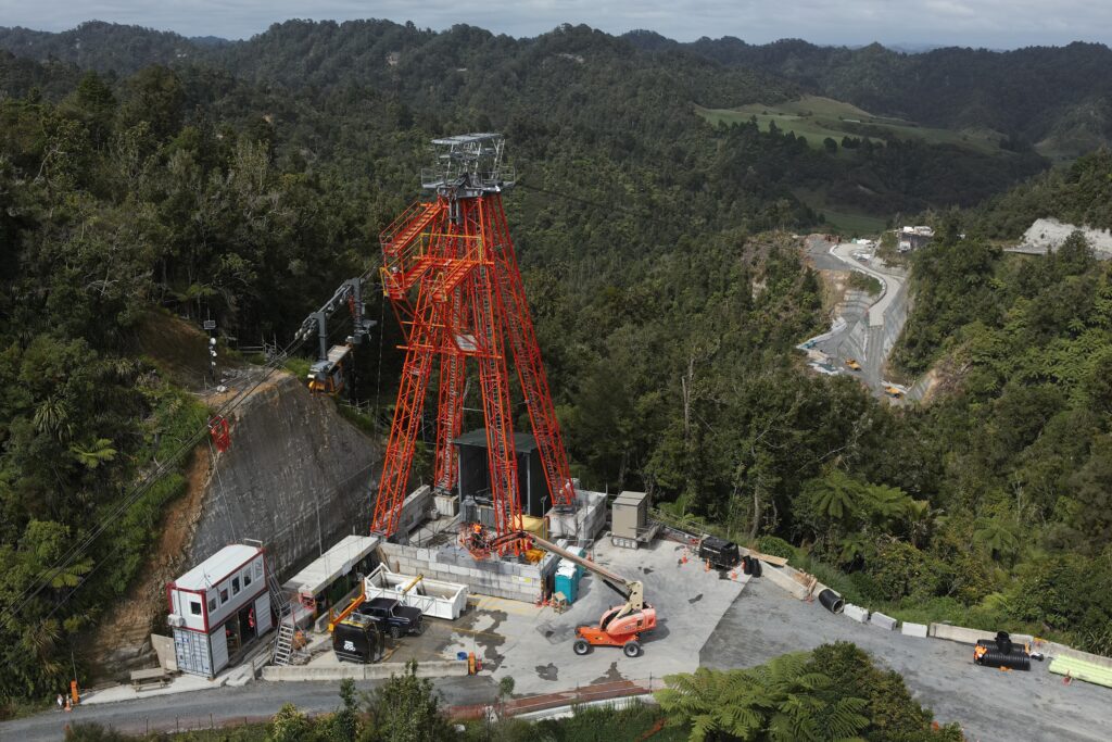
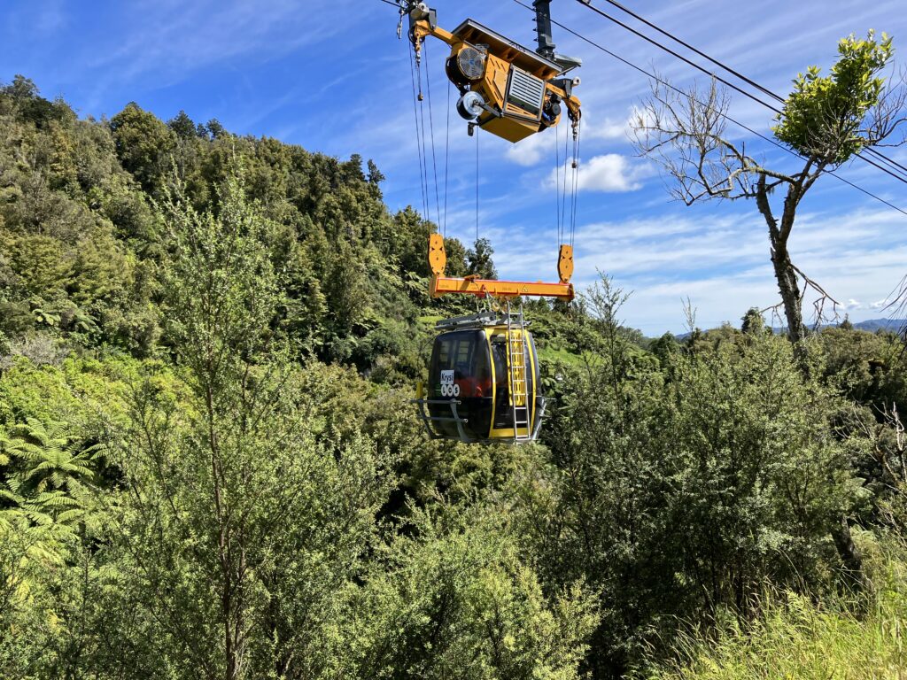
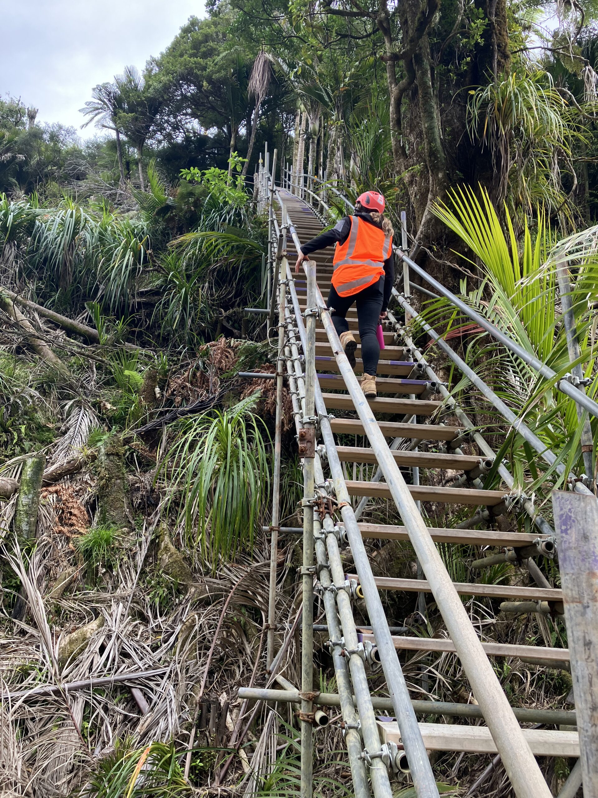
The rough terrain, limited space and access to the site have driven some innovative solutions, such as the construction of a 0.7 mile (1.1 km) long cableway (Figure 2). This is the first of its kind to be used in New Zealand for the construction of a highway. The cableway provides access to the remote northern section of the project, which is otherwise only accessible by foot. With a load capacity of 44,092 pounds (20 tonnes), the cableway brings materials and machinery into the work area. Large machines must be transported in sections and built on-site. A custom eight-person gondola carries trained personnel on a 10-minute trip into the gully (Figure 3). When the gondola is not available, the alternative access route is scaffold staircases, with over 700 stairs and 656 feet (200 meters) of elevation gain (Figure 4).
Access and space restraints have meant earthworks must begin before the installation of typical erosion and sediment controls (ESCs). In large parts of the site, these restraints have been a common problem. This situation has meant our team has developed innovative staging and designs to ensure construction could progress without adverse environmental effects.
The largest fill site on the project is known as Fill 12 and requires the filling of three main gullies to a depth of 131.2 feet (40 m), with
approximately 78,4770 yard3 (600,000 m3) of material. To start this fill, a 0.43-mile (700-m) section of stream had to be diverted through
55-inch (1,400 mm) pipes. This work was completed under an online methodology that had to accommodate a one-in-100-year rainfall event (5.9 inches [151 mm] per 10 minutes).
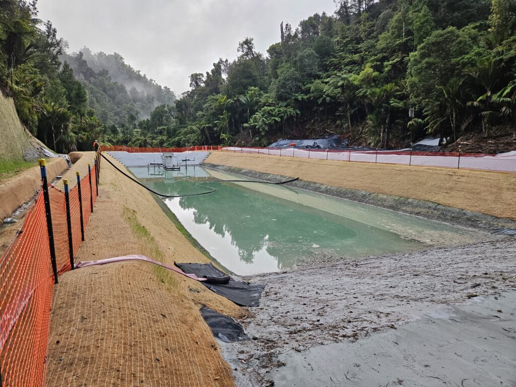
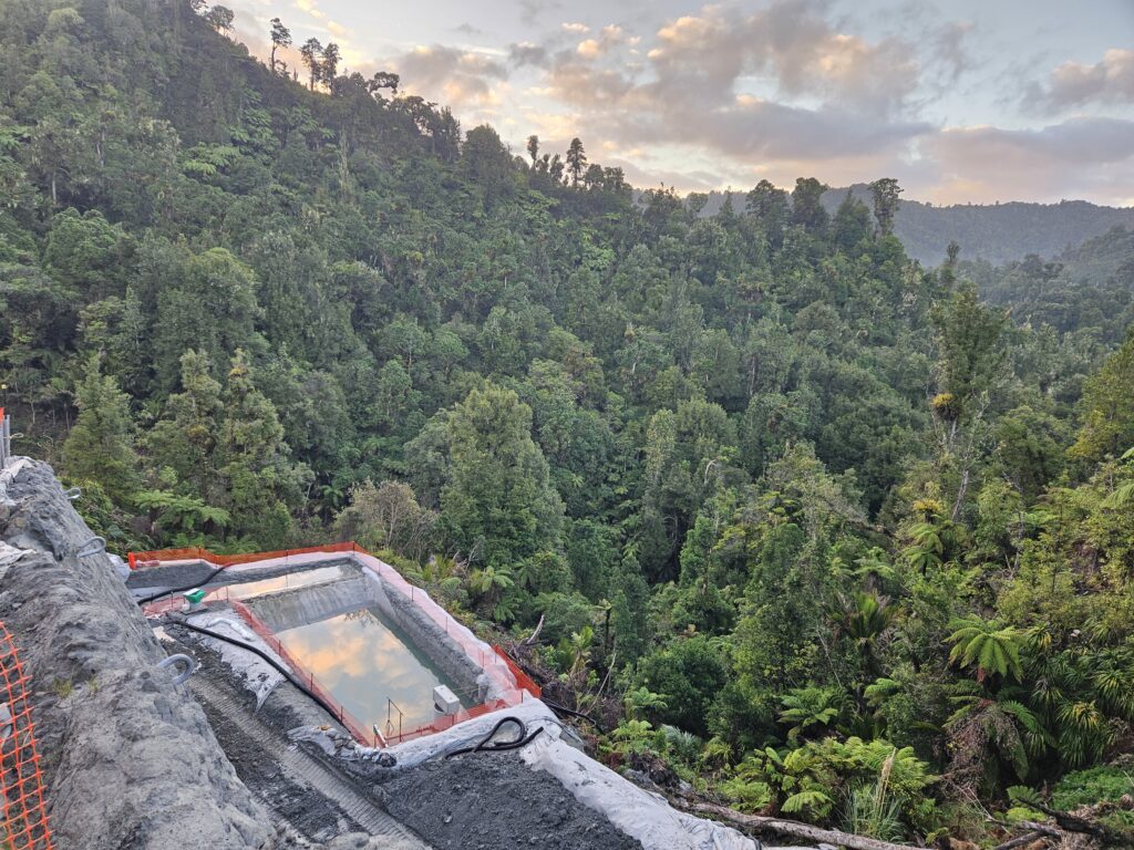
Once a small portion of the stream diversion was completed, the fill height was increased sufficiently to allow a small sediment pond to be installed. This process repeated several times over the construction season with an additional two large sediment ponds constructed completely in fill to accommodate the dirty water catchment of the site. The period between having the ponds constructed meant all un-stabilised catchment had to be completed under a “cut-and-cover” methodology, meaning large areas of the site were covered with polythene and geotextile to eliminate sediment run-off. Since beginning these stream diversion works in 2023, we have managed to fill the area to a sufficient height to allow for a large sediment retention pond with a capacity of 12 acres (5 ha) of catchment, to be constructed at the most downstream extent of the site (Figure 5).
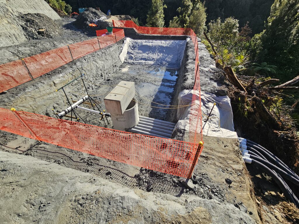
Site access and other limitations have led to the development of unconventional ESCs, which require third-party technical review before installation. One example of this unconventional ESC is a sediment pond outlet structure that sought to disperse discharge flows to prevent erosion on a 30-degree slope (Figure 6). Using a concrete manhole riser and six perforated outlet pipes, the authors were successfully able to prevent scour and erosion. The device performs as well as those with traditional outlet structures in terms of meeting discharge requirements (Figure 7). This innovative approach received the Excellence in Innovation award from the International Erosion Control Association (Australasia).
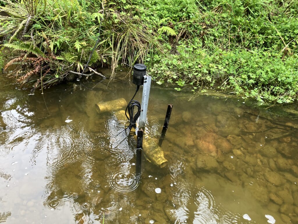
Given the ecological and cultural significance of the landscape, effective ESCs are essential. A comprehensive monitoring programme informs the construction team about the effectiveness of controls on-site. This includes baseline monitoring of water quality, ecological markers, routine monitoring of devices and controls, rainfall-based water quality, ecological monitoring, continuous in-stream nephelometric turbidity unit (NTU) monitoring and in-stream static sampling. Telemetered in-stream NTU monitors at six locations across the alignment provide real-time insight into stream conditions (Figure 8).
The Project Regulator (Taranaki Regional Council) receives automatic notifications when downstream NTU exceeds an agreed “trigger level.” This encourages open communication between the Alliance and Regulator regarding on-site activities. Additionally, we have been able to use the NTU monitors to develop a “risk-based” approach when completing in-stream works. Escalating NTU trigger alerts are sent to key staff members, and construction work will cease before the downstream agreed trigger level is reached, which eliminates sediment deposition and downstream ecological impacts.
To encourage transparency and accountability regarding water quality monitoring, upstream and downstream NTU data are made publicly available each week. Additionally, after a rain event (0.98 inches [25 mm]/24 hours or 0.59 inches [15 mm]/60 minutes), a rainfall trigger inspection report is sent to the Regulator. These reports are also made publicly available and include inlet and outlet NTU, clarity and pH results from each sediment treatment pond on site. In-stream static sampler NTU, total suspended solids and pH, and sediment deposition results in the Mimi Wetland are also made available.
The ESC requirements of the project are managed on-site by the ESC team lead with two senior ESC advisors. This core team works closely with two ESC supervisors and a team of skilled labourers split across the active construction zones. The ESC team collaborates closely with the ecology and engineering teams to develop construction methodologies that meet the requirements of all disciplines. The process to develop effective ESCs on-site is thoroughly planned, reviewed and implemented. A “feedback loop” process is used to allow learnings to be incorporated back into management plans to ensure continuous improvement.
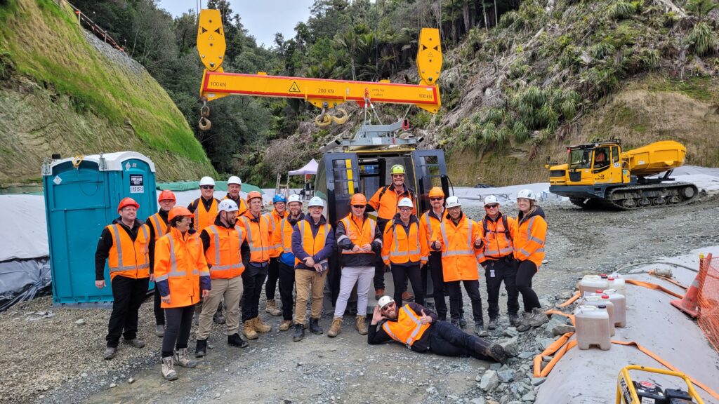
Te Ara o Te Ata is using a holistic approach to environmental management. While working in a challenging environment, the Alliance has used an adaptive strategy for erosion and sediment controls. Te Ara o Te Ata will have quantifiable benefits that stretch beyond the delivery of a road. These gains include innovation and knowledge-sharing with the industry (Figure 9), social and cultural benefits, and positive ecological outcomes that will leave a lasting legacy on the Taranaki region.
About the Experts
• Megan Dredge, CEnvP, is the ESC Team Lead for the Mount Messenger Bypass and is director of MPD Environmental Limited, a consulting firm in New Zealand. She has over 10 years of experience working in the ESC industry on large infrastructure projects.
• Jessica Griffiths, PGDip (Environmental Science), is a senior environmental advisor with HEB Construction, based at Te Ara o Te Ata. She is a certified environmental professional with seven years of experience across civil construction, tunnelling and mining.
• James. B Skurupey, MSc (ENVR), CEnvP, has 17 years of experience in the environmental industry, including roles as consent officer, resource management officer, environmental advisor and manager, as well as a stormwater engineer. Skurupey’s experience is across New Zealand’s local government, civil construction and mining industries.


